

Nice loop
A cycling route starting in West Pleasant View, Colorado, United States.
Overview
About this route
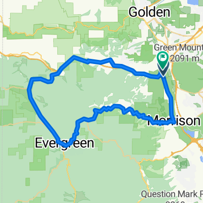
40-74-Squaw Pass Road-Evergreen-Morrison
- -:--
- Duration
- 86.2 km
- Distance
- 1,305 m
- Ascent
- 1,304 m
- Descent
- ---
- Avg. speed
- ---
- Max. altitude
Route quality
Waytypes & surfaces along the route
Waytypes
Road
32.7 km
(38 %)
Busy road
32.3 km
(37 %)
Surfaces
Paved
76.2 km
(88 %)
Unpaved
3.6 km
(4 %)
Asphalt
66.7 km
(77 %)
Concrete
4.8 km
(6 %)
Continue with Bikemap
Use, edit, or download this cycling route
You would like to ride Nice loop or customize it for your own trip? Here is what you can do with this Bikemap route:
Free features
- Save this route as favorite or in collections
- Copy & plan your own version of this route
- Split it into stages to create a multi-day tour
- Sync your route with Garmin or Wahoo
Premium features
Free trial for 3 days, or one-time payment. More about Bikemap Premium.
- Navigate this route on iOS & Android
- Export a GPX / KML file of this route
- Create your custom printout (try it for free)
- Download this route for offline navigation
Discover more Premium features.
Get Bikemap PremiumFrom our community
Other popular routes starting in West Pleasant View
 Denver Loop
- Distance
- 68.5 km
- Ascent
- 387 m
- Descent
- 380 m
- Location
- West Pleasant View, Colorado, United States
 South Table Mesa
- Distance
- 11 km
- Ascent
- 212 m
- Descent
- 226 m
- Location
- West Pleasant View, Colorado, United States
 02. Denver - Lincoln - Omaha
- Distance
- 1,046.8 km
- Ascent
- 2,163 m
- Descent
- 3,821 m
- Location
- West Pleasant View, Colorado, United States
 Nice loop
- Distance
- 86.2 km
- Ascent
- 1,305 m
- Descent
- 1,304 m
- Location
- West Pleasant View, Colorado, United States
 Bike ride 08/01/2015
- Distance
- 112.5 km
- Ascent
- 1,540 m
- Descent
- 1,540 m
- Location
- West Pleasant View, Colorado, United States
 test climb
- Distance
- 54.1 km
- Ascent
- 893 m
- Descent
- 893 m
- Location
- West Pleasant View, Colorado, United States
 GM Short Ride #1
- Distance
- 12.6 km
- Ascent
- 533 m
- Descent
- 536 m
- Location
- West Pleasant View, Colorado, United States
 Golden Short #2
- Distance
- 47.4 km
- Ascent
- 746 m
- Descent
- 748 m
- Location
- West Pleasant View, Colorado, United States
Open it in the app