

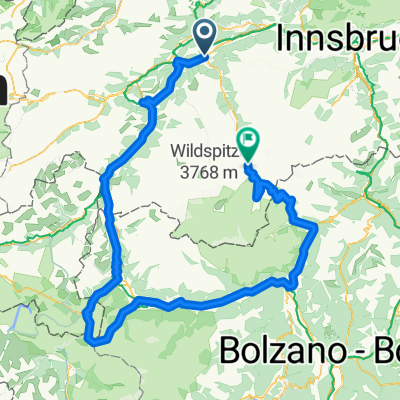
Route
A cycling route starting in Roppen, Tyrol, Austria.
Overview
About this route
- -:--
- Duration
- 17.6 km
- Distance
- 1,034 m
- Ascent
- 214 m
- Descent
- ---
- Avg. speed
- ---
- Max. altitude

Continue with Bikemap
Use, edit, or download this cycling route
You would like to ride Route or customize it for your own trip? Here is what you can do with this Bikemap route:
Free features
- Save this route as favorite or in collections
- Copy & plan your own version of this route
- Sync your route with Garmin or Wahoo
Premium features
Free trial for 3 days, or one-time payment. More about Bikemap Premium.
- Navigate this route on iOS & Android
- Export a GPX / KML file of this route
- Create your custom printout (try it for free)
- Download this route for offline navigation
Discover more Premium features.
Get Bikemap PremiumFrom our community
Other popular routes starting in Roppen
 Industriegebiet 1106/1 to Straße ohne Straßennamen, Gaschurn
- Distance
- 82.5 km
- Ascent
- 3,498 m
- Descent
- 2,370 m
- Location
- Roppen, Tyrol, Austria
 Industriegebiet 1106/1 to Straße ohne Straßennamen, Gaschurn
- Distance
- 73.8 km
- Ascent
- 2,576 m
- Descent
- 1,448 m
- Location
- Roppen, Tyrol, Austria
 Kronburg von Roppen
- Distance
- 18.1 km
- Ascent
- 448 m
- Descent
- 241 m
- Location
- Roppen, Tyrol, Austria
 Alpen15-2
- Distance
- 101 km
- Ascent
- 1,593 m
- Descent
- 1,404 m
- Location
- Roppen, Tyrol, Austria
 Stilfzer Joch Rundkurs
- Distance
- 274.4 km
- Ascent
- 5,323 m
- Descent
- 4,705 m
- Location
- Roppen, Tyrol, Austria
 2012 - 6. Tag - Roppen-Oberammergau
- Distance
- 84.6 km
- Ascent
- 794 m
- Descent
- 661 m
- Location
- Roppen, Tyrol, Austria
 Trankhütte, Roppen nach Rathausstraße 9, Imst
- Distance
- 9.7 km
- Ascent
- 251 m
- Descent
- 198 m
- Location
- Roppen, Tyrol, Austria
![20230814-[R] Roppen Sportplatz Cafe Roppen - Landesstraße 12b Oberhofen](https://media.bikemap.net/routes/13462726/staticmaps/in_3fdfabfb-28fb-4138-b606-4e89b41689c4_400x400_bikemap-2021-3D-static.png) 20230814-[R] Roppen Sportplatz Cafe Roppen - Landesstraße 12b Oberhofen
20230814-[R] Roppen Sportplatz Cafe Roppen - Landesstraße 12b Oberhofen- Distance
- 28.2 km
- Ascent
- 191 m
- Descent
- 265 m
- Location
- Roppen, Tyrol, Austria
Open it in the app