

Ibach Park to Tile Flat Rd
A cycling route starting in Tualatin, Oregon, United States.
Overview
About this route
Tualatin, Ibach Park through Sherwood, Sherwood Scholls, Hillsboro Hwy, Farmington, Tile Flat, Roy Rogers, Beef Bend, Durham Cook Park, Boone's Ferry, Ibach
- -:--
- Duration
- 55.3 km
- Distance
- 266 m
- Ascent
- 272 m
- Descent
- ---
- Avg. speed
- ---
- Max. altitude
Route quality
Waytypes & surfaces along the route
Waytypes
Road
10.5 km
(19 %)
Quiet road
3.3 km
(6 %)
Surfaces
Paved
28.2 km
(51 %)
Unpaved
0.6 km
(1 %)
Asphalt
26.5 km
(48 %)
Paved (undefined)
1.1 km
(2 %)
Continue with Bikemap
Use, edit, or download this cycling route
You would like to ride Ibach Park to Tile Flat Rd or customize it for your own trip? Here is what you can do with this Bikemap route:
Free features
- Save this route as favorite or in collections
- Copy & plan your own version of this route
- Sync your route with Garmin or Wahoo
Premium features
Free trial for 3 days, or one-time payment. More about Bikemap Premium.
- Navigate this route on iOS & Android
- Export a GPX / KML file of this route
- Create your custom printout (try it for free)
- Download this route for offline navigation
Discover more Premium features.
Get Bikemap PremiumFrom our community
Other popular routes starting in Tualatin
 Ibach Park to Tile Flat Rd
- Distance
- 55.3 km
- Ascent
- 266 m
- Descent
- 272 m
- Location
- Tualatin, Oregon, United States
 Tualatin River
- Distance
- 37.6 km
- Ascent
- 341 m
- Descent
- 339 m
- Location
- Tualatin, Oregon, United States
 Tualatin to Downtown Portland
- Distance
- 29.7 km
- Ascent
- 288 m
- Descent
- 268 m
- Location
- Tualatin, Oregon, United States
 Walk with Jan in Tualatin
- Distance
- 11.9 km
- Ascent
- 71 m
- Descent
- 67 m
- Location
- Tualatin, Oregon, United States
 45 mi, 2788ft city route
- Distance
- 74.4 km
- Ascent
- 533 m
- Descent
- 523 m
- Location
- Tualatin, Oregon, United States
 Ibach & back
- Distance
- 6 km
- Ascent
- 73 m
- Descent
- 76 m
- Location
- Tualatin, Oregon, United States
 Home
Home- Distance
- 8.4 km
- Ascent
- 66 m
- Descent
- 67 m
- Location
- Tualatin, Oregon, United States
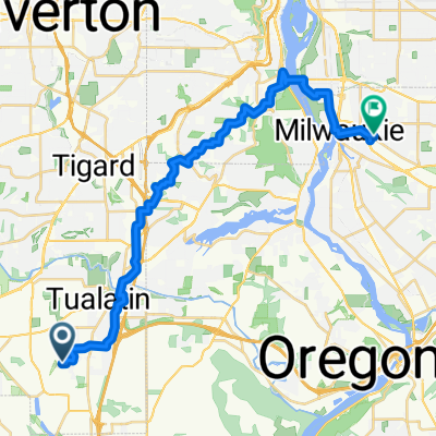 SW 110th Pl, Tualatin to SE Rio Vista St, Milwaukie
- Distance
- 28.6 km
- Ascent
- 418 m
- Descent
- 487 m
- Location
- Tualatin, Oregon, United States
Open it in the app