

Landschaft von Menschenhand
A cycling route starting in Bad Liebenwerda, Brandenburg, Germany.
Overview
About this route
Cultural Area of the Lower Lusatian Heath Landscape
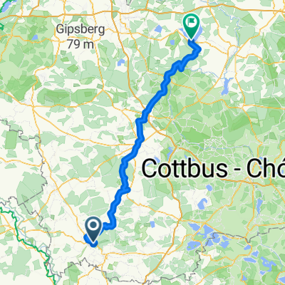
About 130,000 years ago, the retreating glaciers of the Saale Ice Age shaped the surface features of the landscape in the Lower Lusatian Heath Landscape Nature Park – but the character of the landscape today also clearly bears the mark of human activity. At the latest since the modern era, humans have significantly influenced the landscape, creating new settlements and water bodies in a dynamic process, cultivating open land and forests, straightening rivers, and extracting mineral resources. The nature of the landscape is not constant but the result of continuous change. Land uses begin and end, change, and continue in different forms or other locations. This route invites cyclists to discover on a day trip how humans have shaped the landscape. It runs along paths that seem to have been drawn with a ruler, past pits where mineral resources were once extracted, and through extensive heath carpets that, although their existence is also due to human activity, now offer a true natural spectacle when they glow purple in late summer.- -:--
- Duration
- 35.3 km
- Distance
- 99 m
- Ascent
- 99 m
- Descent
- ---
- Avg. speed
- ---
- Max. altitude
Route quality
Waytypes & surfaces along the route
Waytypes
Track
14.5 km
(41 %)
Quiet road
7.1 km
(20 %)
Surfaces
Paved
21.9 km
(62 %)
Unpaved
11.3 km
(32 %)
Asphalt
20.1 km
(57 %)
Gravel
8.5 km
(24 %)
Continue with Bikemap
Use, edit, or download this cycling route
You would like to ride Landschaft von Menschenhand or customize it for your own trip? Here is what you can do with this Bikemap route:
Free features
- Save this route as favorite or in collections
- Copy & plan your own version of this route
- Sync your route with Garmin or Wahoo
Premium features
Free trial for 3 days, or one-time payment. More about Bikemap Premium.
- Navigate this route on iOS & Android
- Export a GPX / KML file of this route
- Create your custom printout (try it for free)
- Download this route for offline navigation
Discover more Premium features.
Get Bikemap PremiumFrom our community
Other popular routes starting in Bad Liebenwerda
 Chemnitz-Usedom; 2.Etappe
- Distance
- 126.9 km
- Ascent
- 149 m
- Descent
- 203 m
- Location
- Bad Liebenwerda, Brandenburg, Germany
 Herrentagstour 2017 Tag 3.Samstag, 27.05. 17: Senftenberg - Bad - Liebenwerda
- Distance
- 53 km
- Ascent
- 174 m
- Descent
- 159 m
- Location
- Bad Liebenwerda, Brandenburg, Germany
 Von Bad Liebenwerda nach Forst
- Distance
- 115 km
- Ascent
- 188 m
- Descent
- 200 m
- Location
- Bad Liebenwerda, Brandenburg, Germany
 50Km Liebenwerda Doberlugk Tröbitz, Rundfahrt
- Distance
- 50 km
- Ascent
- 142 m
- Descent
- 143 m
- Location
- Bad Liebenwerda, Brandenburg, Germany
 Wasser, Wald und Wackerstein
- Distance
- 36.3 km
- Ascent
- 116 m
- Descent
- 116 m
- Location
- Bad Liebenwerda, Brandenburg, Germany
 2.Tag, Bad Liebenwerda- Cottbus
- Distance
- 103.8 km
- Ascent
- 214 m
- Descent
- 223 m
- Location
- Bad Liebenwerda, Brandenburg, Germany
 Day 3
Day 3- Distance
- 144.7 km
- Ascent
- 253 m
- Descent
- 313 m
- Location
- Bad Liebenwerda, Brandenburg, Germany
 Auf den Spuren der Mönche von Dobrilugk
- Distance
- 107.4 km
- Ascent
- 143 m
- Descent
- 145 m
- Location
- Bad Liebenwerda, Brandenburg, Germany
Open it in the app