

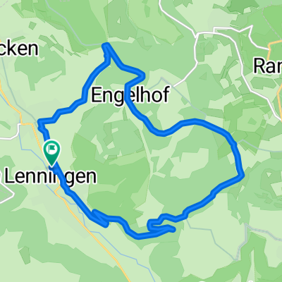
14 km Oberlenningen - Engelhof - Oberlenningen
A cycling route starting in Erkenbrechtsweiler, Baden-Wurttemberg, Germany.
Overview
About this route
Bhf Oberlenningen, right onto Lenningertal bike path, follow Heerweg, then left outside of the town. Asphalt until the plateau. On the plateau, take the gravel path to the left and follow it. At Engelhof (farm), turn left, initially slightly descending then increasingly steep descent on gravel. At the crossroads, left, the rest of the route is not on asphalt. In the town, turn left onto Friedensstraße, which joins back onto the Lenningertal bike path before the level crossing.
- -:--
- Duration
- 13.6 km
- Distance
- 469 m
- Ascent
- 472 m
- Descent
- ---
- Avg. speed
- ---
- Max. altitude
Route quality
Waytypes & surfaces along the route
Waytypes
Track
11.4 km
(84 %)
Quiet road
1.6 km
(12 %)
Surfaces
Paved
9.6 km
(71 %)
Unpaved
3.8 km
(28 %)
Asphalt
8.7 km
(64 %)
Gravel
2.4 km
(18 %)
Continue with Bikemap
Use, edit, or download this cycling route
You would like to ride 14 km Oberlenningen - Engelhof - Oberlenningen or customize it for your own trip? Here is what you can do with this Bikemap route:
Free features
- Save this route as favorite or in collections
- Copy & plan your own version of this route
- Sync your route with Garmin or Wahoo
Premium features
Free trial for 3 days, or one-time payment. More about Bikemap Premium.
- Navigate this route on iOS & Android
- Export a GPX / KML file of this route
- Create your custom printout (try it for free)
- Download this route for offline navigation
Discover more Premium features.
Get Bikemap PremiumFrom our community
Other popular routes starting in Erkenbrechtsweiler
 14 km Oberlenningen - Engelhof - Oberlenningen
- Distance
- 13.6 km
- Ascent
- 469 m
- Descent
- 472 m
- Location
- Erkenbrechtsweiler, Baden-Wurttemberg, Germany
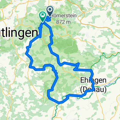 Alb Extrem 2021
- Distance
- 160.9 km
- Ascent
- 1,500 m
- Descent
- 1,213 m
- Location
- Erkenbrechtsweiler, Baden-Wurttemberg, Germany
 Lenningen-GrauerStein-Süssen-Wernau-Lenningen
- Distance
- 102 km
- Ascent
- 687 m
- Descent
- 769 m
- Location
- Erkenbrechtsweiler, Baden-Wurttemberg, Germany
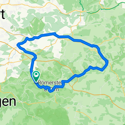
 15 km Asch-Umrundung
- Distance
- 14.6 km
- Ascent
- 402 m
- Descent
- 402 m
- Location
- Erkenbrechtsweiler, Baden-Wurttemberg, Germany
 Lenningen-Nürtingen-Gniebel-Wendlingen-Lenningen
- Distance
- 77.8 km
- Ascent
- 521 m
- Descent
- 587 m
- Location
- Erkenbrechtsweiler, Baden-Wurttemberg, Germany
 Unterlenningen - Asch-Schopfloch
- Distance
- 22.9 km
- Ascent
- 500 m
- Descent
- 500 m
- Location
- Erkenbrechtsweiler, Baden-Wurttemberg, Germany
 Auf der Alb II
- Distance
- 50.7 km
- Ascent
- 394 m
- Descent
- 392 m
- Location
- Erkenbrechtsweiler, Baden-Wurttemberg, Germany
 Osterrunde
- Distance
- 58.5 km
- Ascent
- 788 m
- Descent
- 793 m
- Location
- Erkenbrechtsweiler, Baden-Wurttemberg, Germany
Open it in the app