sortie07052022
- 73.2 km
- 827 m
- 827 m
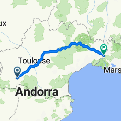
- Labarthe-Rivière, Occitanie, France
A cycling route starting in Labarthe-Rivière, Occitanie, France.
Overview
CDP - Juzet-d'Izaut - Saint-Bertrand-de-Comminges
created this 10 years ago
Route quality
Road
7.8 km
(30 %)
Quiet road
7 km
(27 %)
Paved
12.2 km
(47 %)
Unpaved
0.3 km
(1 %)
Asphalt
12.2 km
(47 %)
Gravel
0.3 km
(1 %)
Undefined
13.5 km
(52 %)
Continue with Bikemap
You would like to ride CDP-08b-mont-de-galie-nestier or customize it for your own trip? Here is what you can do with this Bikemap route:
Free trial for 3 days, or one-time payment. More about Bikemap Premium.
Discover more Premium features.
Get Bikemap PremiumFrom our community
Open it in the app