

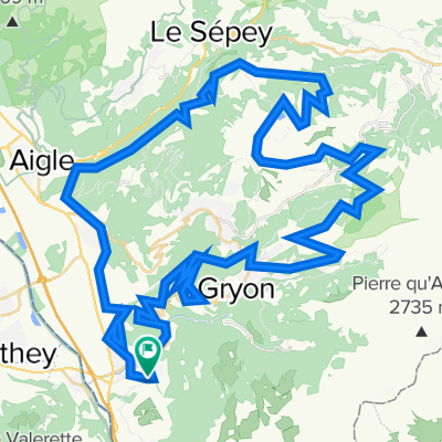
Aigle-Seppey-Forclaz-Leglise-Mosses-Moellé-Leysin-Aigle
A cycling route starting in Bex, Canton of Vaud, Switzerland.
Overview
About this route
Seldom travelled
- -:--
- Duration
- 83.1 km
- Distance
- 1,741 m
- Ascent
- 1,741 m
- Descent
- ---
- Avg. speed
- ---
- Max. altitude

Route quality
Waytypes & surfaces along the route
Waytypes
Quiet road
37.4 km
(45 %)
Road
13.3 km
(16 %)
Surfaces
Paved
41.5 km
(50 %)
Unpaved
1.7 km
(2 %)
Asphalt
38.2 km
(46 %)
Paved (undefined)
2.5 km
(3 %)
Continue with Bikemap
Use, edit, or download this cycling route
You would like to ride Aigle-Seppey-Forclaz-Leglise-Mosses-Moellé-Leysin-Aigle or customize it for your own trip? Here is what you can do with this Bikemap route:
Free features
- Save this route as favorite or in collections
- Copy & plan your own version of this route
- Split it into stages to create a multi-day tour
- Sync your route with Garmin or Wahoo
Premium features
Free trial for 3 days, or one-time payment. More about Bikemap Premium.
- Navigate this route on iOS & Android
- Export a GPX / KML file of this route
- Create your custom printout (try it for free)
- Download this route for offline navigation
Discover more Premium features.
Get Bikemap PremiumFrom our community
Other popular routes starting in Bex
 Facile à conduire Bex
- Distance
- 28.4 km
- Ascent
- 772 m
- Descent
- 724 m
- Location
- Bex, Canton of Vaud, Switzerland
 Gravel Bex autour de Villars
- Distance
- 76.4 km
- Ascent
- 1,960 m
- Descent
- 1,959 m
- Location
- Bex, Canton of Vaud, Switzerland
 Les Giettes par Vérossaz suivi de Champéry par la route des Rives
- Distance
- 45.1 km
- Ascent
- 1,233 m
- Descent
- 1,231 m
- Location
- Bex, Canton of Vaud, Switzerland
 Val d'Abondance
- Distance
- 103.3 km
- Ascent
- 1,213 m
- Descent
- 1,213 m
- Location
- Bex, Canton of Vaud, Switzerland
 route meer van Geneve 2013
- Distance
- 351.6 km
- Ascent
- 487 m
- Descent
- 476 m
- Location
- Bex, Canton of Vaud, Switzerland
 Monthey -> Genève
- Distance
- 133.1 km
- Ascent
- 2,466 m
- Descent
- 2,492 m
- Location
- Bex, Canton of Vaud, Switzerland
 Tour du Val d’Abondance
- Distance
- 97.3 km
- Ascent
- 1,211 m
- Descent
- 1,210 m
- Location
- Bex, Canton of Vaud, Switzerland
 Grand Tour Val d'Illiez
- Distance
- 93.1 km
- Ascent
- 2,469 m
- Descent
- 2,466 m
- Location
- Bex, Canton of Vaud, Switzerland
Open it in the app