

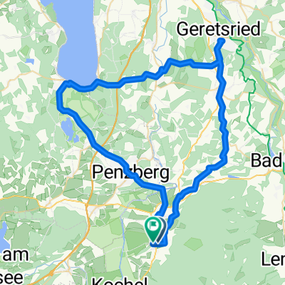
20150912_Benediktbeuern-Seeshaupt-Wolfratshausen-BadToelz
A cycling route starting in Benediktbeuern, Bavaria, Germany.
Overview
About this route
84 km; Startpunkt: Wohnmobilstellplatz in Benediktbeuern GPS N 47°41'56", E 11°24'57"
- -:--
- Duration
- 83.8 km
- Distance
- 452 m
- Ascent
- 452 m
- Descent
- ---
- Avg. speed
- ---
- Avg. speed
Route quality
Waytypes & surfaces along the route
Waytypes
Quiet road
31 km
(37 %)
Busy road
17.8 km
(21 %)
Surfaces
Paved
61.1 km
(73 %)
Unpaved
16 km
(19 %)
Asphalt
59.8 km
(71 %)
Gravel
13.5 km
(16 %)
Continue with Bikemap
Use, edit, or download this cycling route
You would like to ride 20150912_Benediktbeuern-Seeshaupt-Wolfratshausen-BadToelz or customize it for your own trip? Here is what you can do with this Bikemap route:
Free features
- Save this route as favorite or in collections
- Copy & plan your own version of this route
- Sync your route with Garmin or Wahoo
Premium features
Free trial for 3 days, or one-time payment. More about Bikemap Premium.
- Navigate this route on iOS & Android
- Export a GPX / KML file of this route
- Create your custom printout (try it for free)
- Download this route for offline navigation
Discover more Premium features.
Get Bikemap PremiumFrom our community
Other popular routes starting in Benediktbeuern
 Benediktbeuern - Geretsried - Seeshaupt - Penzberg - Benediktbeuern
- Distance
- 63.1 km
- Ascent
- 375 m
- Descent
- 376 m
- Location
- Benediktbeuern, Bavaria, Germany
 Route in Kochel am See
- Distance
- 79.8 km
- Ascent
- 705 m
- Descent
- 705 m
- Location
- Benediktbeuern, Bavaria, Germany
 Benedikbeuern von Kapelle zu Kapelle, Radtour
- Distance
- 25.3 km
- Ascent
- 232 m
- Descent
- 232 m
- Location
- Benediktbeuern, Bavaria, Germany
 Alpen 22 1. Tag
- Distance
- 123.6 km
- Ascent
- 2,364 m
- Descent
- 1,990 m
- Location
- Benediktbeuern, Bavaria, Germany
 20150912_Benediktbeuern-Seeshaupt-Wolfratshausen-BadToelz
- Distance
- 83.8 km
- Ascent
- 452 m
- Descent
- 452 m
- Location
- Benediktbeuern, Bavaria, Germany
 Walchensee-Jachenrunde
- Distance
- 80.3 km
- Ascent
- 521 m
- Descent
- 524 m
- Location
- Benediktbeuern, Bavaria, Germany
 Kirchen und Kapellen des ehem. Benediktbeurer Klosterlands Nord
- Distance
- 23.3 km
- Ascent
- 160 m
- Descent
- 161 m
- Location
- Benediktbeuern, Bavaria, Germany
 Benedikbeuern von Kapelle zu Kapelle, Wanderung
- Distance
- 10.5 km
- Ascent
- 101 m
- Descent
- 101 m
- Location
- Benediktbeuern, Bavaria, Germany
Open it in the app