

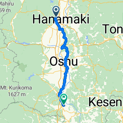
宮城1000K_PC3 - PC4
A cycling route starting in Hanamaki, Iwate, Japan.
Overview
About this route
PC4 ローソン釜石駅前店
左側 N283【14/06:42~14/18:28】- -:--
- Duration
- 87.9 km
- Distance
- 1,006 m
- Ascent
- 1,070 m
- Descent
- ---
- Avg. speed
- ---
- Max. altitude

Continue with Bikemap
Use, edit, or download this cycling route
You would like to ride 宮城1000K_PC3 - PC4 or customize it for your own trip? Here is what you can do with this Bikemap route:
Free features
- Save this route as favorite or in collections
- Copy & plan your own version of this route
- Split it into stages to create a multi-day tour
- Sync your route with Garmin or Wahoo
Premium features
Free trial for 3 days, or one-time payment. More about Bikemap Premium.
- Navigate this route on iOS & Android
- Export a GPX / KML file of this route
- Create your custom printout (try it for free)
- Download this route for offline navigation
Discover more Premium features.
Get Bikemap PremiumFrom our community
Other popular routes starting in Hanamaki
 8-20, Zaimokucho, Hanamaki-Shi to 31-3, Mizusawashinjo Tsuka, Oshu-Shi
- Distance
- 47.3 km
- Ascent
- 246 m
- Descent
- 261 m
- Location
- Hanamaki, Iwate, Japan
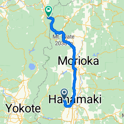
 Hanamaki - Morioka
- Distance
- 49.1 km
- Ascent
- 111 m
- Descent
- 64 m
- Location
- Hanamaki, Iwate, Japan
 宮城1000K_PC3 - PC4
- Distance
- 87.9 km
- Ascent
- 1,006 m
- Descent
- 1,070 m
- Location
- Hanamaki, Iwate, Japan
 Hanamaki - Ichinoseki
- Distance
- 80.6 km
- Ascent
- 502 m
- Descent
- 605 m
- Location
- Hanamaki, Iwate, Japan
 Kutashizawa Nakano, Hanamaki to Hachimantai Yuzeyunomukai, Kazuno
- Distance
- 126.4 km
- Ascent
- 1,372 m
- Descent
- 1,357 m
- Location
- Hanamaki, Iwate, Japan
 hanamanki to tono
- Distance
- 49.4 km
- Ascent
- 695 m
- Descent
- 500 m
- Location
- Hanamaki, Iwate, Japan
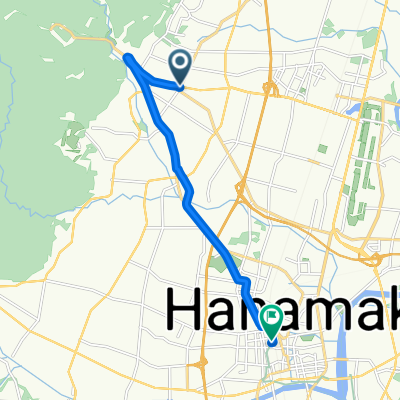 Yumoto Dai4Chiwari, Hanamaki to Zaimokucho, Hanamaki
- Distance
- 10.1 km
- Ascent
- 89 m
- Descent
- 123 m
- Location
- Hanamaki, Iwate, Japan
 新花卷~遠野
- Distance
- 43.7 km
- Ascent
- 520 m
- Descent
- 341 m
- Location
- Hanamaki, Iwate, Japan
Open it in the app