

dsfsdf
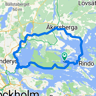
A cycling route starting in Vaxholm, Stockholm County, Sweden.
Overview
About this route
sdfs
- -:--
- Duration
- 240.5 km
- Distance
- 0 m
- Ascent
- 5 m
- Descent
- ---
- Avg. speed
- ---
- Max. altitude
Route highlights
Points of interest along the route
Accommodation after 5.3 km
Svinningen
Accommodation after 16.1 km
Grinda
Accommodation after 117.3 km
Sandhamn
Accommodation after 138.5 km
Dalarö
Accommodation after 153.2 km
Utö
Accommodation after 195.7 km
Satsjöbaden
Point of interest after 229.9 km
Stockholm
Accommodation after 230.1 km
Bosön
Continue with Bikemap
Use, edit, or download this cycling route
You would like to ride dsfsdf or customize it for your own trip? Here is what you can do with this Bikemap route:
Free features
- Save this route as favorite or in collections
- Copy & plan your own version of this route
- Split it into stages to create a multi-day tour
- Sync your route with Garmin or Wahoo
Premium features
Free trial for 3 days, or one-time payment. More about Bikemap Premium.
- Navigate this route on iOS & Android
- Export a GPX / KML file of this route
- Create your custom printout (try it for free)
- Download this route for offline navigation
Discover more Premium features.
Get Bikemap PremiumFrom our community
Other popular routes starting in Vaxholm
 Insel Tour
- Distance
- 60.8 km
- Ascent
- 602 m
- Descent
- 606 m
- Location
- Vaxholm, Stockholm County, Sweden
 Lillsvedsvägen 94, Värmdö to Fiskarvägen 20, Värmdö
- Distance
- 21 km
- Ascent
- 261 m
- Descent
- 254 m
- Location
- Vaxholm, Stockholm County, Sweden
 ZI Waxholm
- Distance
- 34.1 km
- Ascent
- 230 m
- Descent
- 223 m
- Location
- Vaxholm, Stockholm County, Sweden
 Vaxholm camping to waxholmbolaget Ostana
- Distance
- 3.3 km
- Ascent
- 50 m
- Descent
- 58 m
- Location
- Vaxholm, Stockholm County, Sweden
 dsfsdf
- Distance
- 240.5 km
- Ascent
- 0 m
- Descent
- 5 m
- Location
- Vaxholm, Stockholm County, Sweden
 Kustlinjen (15)
- Distance
- 3.5 km
- Ascent
- 61 m
- Descent
- 64 m
- Location
- Vaxholm, Stockholm County, Sweden
Open it in the app