

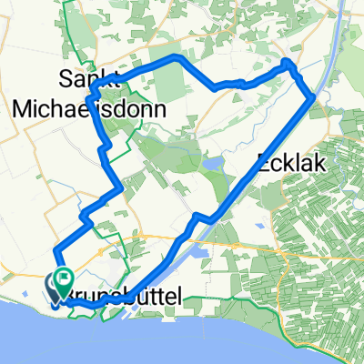
13_Brunsbüttel – Burg – Albersdorf
A cycling route starting in Brunsbüttel, Schleswig-Holstein, Germany.
Overview
About this route
Elbmarschen, Hochbrücken, Steinzeitdorf Charakter: Leichte Kanalufer- und Feldflurfahrt in der Hauptwindrichtung. Verkehr: Am Kanal fast durchgehend autofreie Schotterwege (Kanaluferwege), ansonsten wenig befahrene Nebenstraßen.. KOMPASS 6009 Nord-Ostsee-Kanal-Radweg, Bernhard Pollmann, ISBN 978-3-85026-752-6
- -:--
- Duration
- 47.1 km
- Distance
- 102 m
- Ascent
- 77 m
- Descent
- ---
- Avg. speed
- ---
- Max. altitude
Route highlights
Points of interest along the route

Point of interest after 0 km
Brunsbüttel, Schleuseneinfahrt am Beginn des NOK. Die See- und Kanalhafenstadt Brunsbüttel (Betonung auf der ersten Silbe: brúhnsbüddl) liegt im südlichen Dithmarschen an der Unterelbe, von der hier der Nord-Ostsee-Kanal abzweigt. Im frühen Mittelalter als „Piratennest“ von Seeleuten gefürchtet, ent

Point of interest after 23 km
Hochdonner Hochbrücke Die Hochbrücke ist das Wahrzeichen der kleinen Gemeinde Hochdonn. Die nach den Hochbrücken Levensau und Rendsburg drittälteste NOK-Brücke überquert den Nord-Ostsee-Kanal bei Kanal-Kilometer 18,778 als zweigleisige Eisenbahnbrücke der Marschbahn Hamburg–Sylt. Bild und Text - KOM

Point of interest after 47 km
Flintbek-Haus im Steinzeitdorf in Albersdorf. (Foto: Steinzeitpark Dithmarschen, Albersdorf) Der Luftkurort Albersdorf liegt in Dithmarschen auf der Geest nördlich des Gieselautals. Gegenüber vom Bahnhof Albersdorf ist im Gebäude des ehemaligen Bahnhofshotels das Museum für Archäologie und Ökologie
Continue with Bikemap
Use, edit, or download this cycling route
You would like to ride 13_Brunsbüttel – Burg – Albersdorf or customize it for your own trip? Here is what you can do with this Bikemap route:
Free features
- Save this route as favorite or in collections
- Copy & plan your own version of this route
- Sync your route with Garmin or Wahoo
Premium features
Free trial for 3 days, or one-time payment. More about Bikemap Premium.
- Navigate this route on iOS & Android
- Export a GPX / KML file of this route
- Create your custom printout (try it for free)
- Download this route for offline navigation
Discover more Premium features.
Get Bikemap PremiumFrom our community
Other popular routes starting in Brunsbüttel
 Nord-Ostseekanal
- Distance
- 111.2 km
- Ascent
- 85 m
- Descent
- 82 m
- Location
- Brunsbüttel, Schleswig-Holstein, Germany
 13_Brunsbüttel – Burg – Albersdorf
- Distance
- 47.1 km
- Ascent
- 102 m
- Descent
- 77 m
- Location
- Brunsbüttel, Schleswig-Holstein, Germany
 Brunsbüttel
- Distance
- 44.4 km
- Ascent
- 42 m
- Descent
- 42 m
- Location
- Brunsbüttel, Schleswig-Holstein, Germany
 044 Zipfeltour2012_Tag04_Brunsbüttel-Wedel
- Distance
- 87.8 km
- Ascent
- 14 m
- Descent
- 4 m
- Location
- Brunsbüttel, Schleswig-Holstein, Germany
 Brunsbüttel-Friederichskoog-Brunbüttel
- Distance
- 49.8 km
- Ascent
- 0 m
- Descent
- 0 m
- Location
- Brunsbüttel, Schleswig-Holstein, Germany
 Pinneberg-Brunsbüttel
- Distance
- 68 km
- Ascent
- 0 m
- Descent
- 0 m
- Location
- Brunsbüttel, Schleswig-Holstein, Germany
 NOK Route
- Distance
- 114.7 km
- Ascent
- 156 m
- Descent
- 158 m
- Location
- Brunsbüttel, Schleswig-Holstein, Germany
 Seehundstation Friedrichskoog
- Distance
- 62.4 km
- Ascent
- 0 m
- Descent
- 0 m
- Location
- Brunsbüttel, Schleswig-Holstein, Germany
Open it in the app