

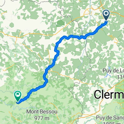
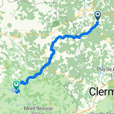
20150830_095334.gpx
A cycling route starting in Commentry, Auvergne-Rhône-Alpes, France.
Overview
About this route
TEASI track
- -:--
- Duration
- 30 km
- Distance
- 302 m
- Ascent
- 296 m
- Descent
- ---
- Avg. speed
- ---
- Max. altitude
Route quality
Waytypes & surfaces along the route
Waytypes
Road
13.2 km
(44 %)
Quiet road
9.9 km
(33 %)
Surfaces
Paved
0.6 km
(2 %)
Unpaved
1.2 km
(4 %)
Gravel
0.9 km
(3 %)
Paved (undefined)
0.6 km
(2 %)
Continue with Bikemap
Use, edit, or download this cycling route
You would like to ride 20150830_095334.gpx or customize it for your own trip? Here is what you can do with this Bikemap route:
Free features
- Save this route as favorite or in collections
- Copy & plan your own version of this route
- Sync your route with Garmin or Wahoo
Premium features
Free trial for 3 days, or one-time payment. More about Bikemap Premium.
- Navigate this route on iOS & Android
- Export a GPX / KML file of this route
- Create your custom printout (try it for free)
- Download this route for offline navigation
Discover more Premium features.
Get Bikemap PremiumFrom our community
Other popular routes starting in Commentry
 Commentry -- La Villedieu 125km 1420HM
- Distance
- 125 km
- Ascent
- 1,200 m
- Descent
- 980 m
- Location
- Commentry, Auvergne-Rhône-Alpes, France
 essai
essai- Distance
- 25.2 km
- Ascent
- 253 m
- Descent
- 252 m
- Location
- Commentry, Auvergne-Rhône-Alpes, France
 20150326_172428.gpx
- Distance
- 13.7 km
- Ascent
- 97 m
- Descent
- 82 m
- Location
- Commentry, Auvergne-Rhône-Alpes, France
 Voyage 2018 - Commentry Vauveix - 123km 1330D+
- Distance
- 122.6 km
- Ascent
- 1,025 m
- Descent
- 758 m
- Location
- Commentry, Auvergne-Rhône-Alpes, France
 20150807_085324.gpx
- Distance
- 34.2 km
- Ascent
- 251 m
- Descent
- 253 m
- Location
- Commentry, Auvergne-Rhône-Alpes, France
 De 1 Les Brandes-Sud, Malicorne à 1 Les Brandes-Sud, Malicorne
- Distance
- 20.5 km
- Ascent
- 201 m
- Descent
- 199 m
- Location
- Commentry, Auvergne-Rhône-Alpes, France
 20150601_181032.gpx
- Distance
- 27.8 km
- Ascent
- 209 m
- Descent
- 209 m
- Location
- Commentry, Auvergne-Rhône-Alpes, France
 20150528_172034.gpx
- Distance
- 24.8 km
- Ascent
- 164 m
- Descent
- 160 m
- Location
- Commentry, Auvergne-Rhône-Alpes, France
Open it in the app