

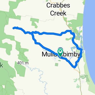
Northern NSW hinterland ride to waterfall
A cycling route starting in Brunswick Heads, New South Wales, Australia.
Overview
About this route
Mostly flat with a steep climb at the last 1000m. Follow gravel road and fire trail to the end to waterfall and swimming hole.
- -:--
- Duration
- 19.5 km
- Distance
- 478 m
- Ascent
- 206 m
- Descent
- ---
- Avg. speed
- ---
- Max. altitude
Route quality
Waytypes & surfaces along the route
Waytypes
Road
12.7 km
(65 %)
Quiet road
6.8 km
(35 %)
Surfaces
Paved
17.4 km
(89 %)
Unpaved
2 km
(10 %)
Asphalt
16.4 km
(84 %)
Unpaved (undefined)
2 km
(10 %)
Route highlights
Points of interest along the route
Point of interest after 0.1 km
Pie shop
Point of interest after 10 km
First hill
Point of interest after 14.7 km
Second hill Main ascent starts here
Point of interest after 17.5 km
Start of steep climb next 500m
Point of interest after 19.5 km
Take Middle Ridge turn off
Point of interest after 19.5 km
Road ends here
Continue with Bikemap
Use, edit, or download this cycling route
You would like to ride Northern NSW hinterland ride to waterfall or customize it for your own trip? Here is what you can do with this Bikemap route:
Free features
- Save this route as favorite or in collections
- Copy & plan your own version of this route
- Sync your route with Garmin or Wahoo
Premium features
Free trial for 3 days, or one-time payment. More about Bikemap Premium.
- Navigate this route on iOS & Android
- Export a GPX / KML file of this route
- Create your custom printout (try it for free)
- Download this route for offline navigation
Discover more Premium features.
Get Bikemap PremiumFrom our community
Other popular routes starting in Brunswick Heads
- Brunswick to Tweed Beach and River Ride
- Distance
- 44.3 km
- Ascent
- 97 m
- Descent
- 97 m
- Location
- Brunswick Heads, New South Wales, Australia
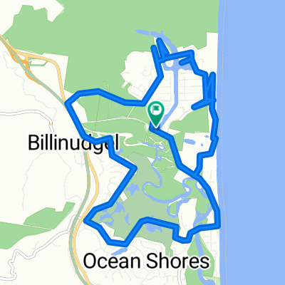 South Golden ~ Ocean Shores circuit
- Distance
- 18.7 km
- Ascent
- 104 m
- Descent
- 106 m
- Location
- Brunswick Heads, New South Wales, Australia
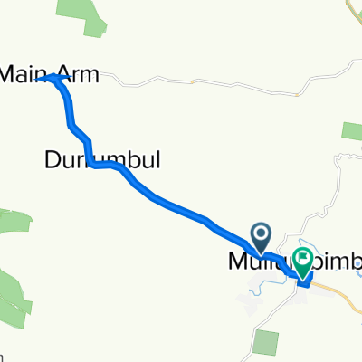 mullumbimby
- Distance
- 19.7 km
- Ascent
- 133 m
- Descent
- 134 m
- Location
- Brunswick Heads, New South Wales, Australia
 Brunswick to Byron return trip
- Distance
- 27.8 km
- Ascent
- 374 m
- Descent
- 368 m
- Location
- Brunswick Heads, New South Wales, Australia
 backcountry ride.
- Distance
- 49.4 km
- Ascent
- 239 m
- Descent
- 238 m
- Location
- Brunswick Heads, New South Wales, Australia
 Mullum to Flatrock
- Distance
- 49.1 km
- Ascent
- 474 m
- Descent
- 474 m
- Location
- Brunswick Heads, New South Wales, Australia
 Fire trail ride
- Distance
- 8.9 km
- Ascent
- 80 m
- Descent
- 78 m
- Location
- Brunswick Heads, New South Wales, Australia
 Mullumbimby to Evans Head
- Distance
- 95.1 km
- Ascent
- 172 m
- Descent
- 172 m
- Location
- Brunswick Heads, New South Wales, Australia

Open it in the app