

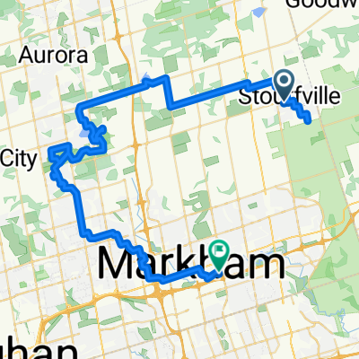
Markham
A cycling route starting in Markham, Ontario, Canada.
Overview
About this route
2015-09-14, 4:25 PM
- -:--
- Duration
- 17.4 km
- Distance
- 76 m
- Ascent
- 76 m
- Descent
- ---
- Avg. speed
- ---
- Max. altitude
Route quality
Waytypes & surfaces along the route
Waytypes
Road
4.9 km
(28 %)
Quiet road
2.3 km
(13 %)
Surfaces
Paved
16.7 km
(96 %)
Asphalt
13.4 km
(77 %)
Concrete
3 km
(17 %)
Continue with Bikemap
Use, edit, or download this cycling route
You would like to ride Markham or customize it for your own trip? Here is what you can do with this Bikemap route:
Free features
- Save this route as favorite or in collections
- Copy & plan your own version of this route
- Sync your route with Garmin or Wahoo
Premium features
Free trial for 3 days, or one-time payment. More about Bikemap Premium.
- Navigate this route on iOS & Android
- Export a GPX / KML file of this route
- Create your custom printout (try it for free)
- Download this route for offline navigation
Discover more Premium features.
Get Bikemap PremiumFrom our community
Other popular routes starting in Markham
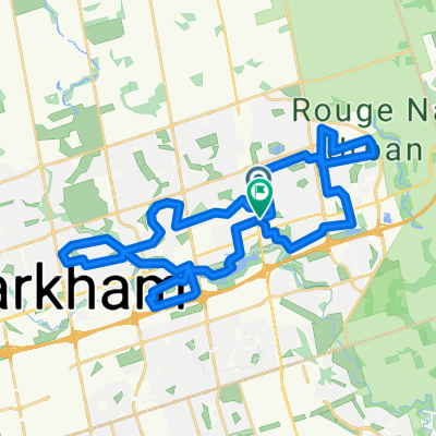
 Stouffville to Unionville Via Lake Wilcox and Oak Ridges Trail
- Distance
- 67.7 km
- Ascent
- 317 m
- Descent
- 412 m
- Location
- Markham, Ontario, Canada
 Egypt to Glasgow
- Distance
- 99.9 km
- Ascent
- 338 m
- Descent
- 338 m
- Location
- Markham, Ontario, Canada
 Journey for Hope 40 km
- Distance
- 39.7 km
- Ascent
- 170 m
- Descent
- 170 m
- Location
- Markham, Ontario, Canada
 Randonneur Brevet - Scugog Circle - 200 k
- Distance
- 206.6 km
- Ascent
- 872 m
- Descent
- 838 m
- Location
- Markham, Ontario, Canada
 Treeline Court to Main Street Unionville
- Distance
- 11.5 km
- Ascent
- 84 m
- Descent
- 70 m
- Location
- Markham, Ontario, Canada
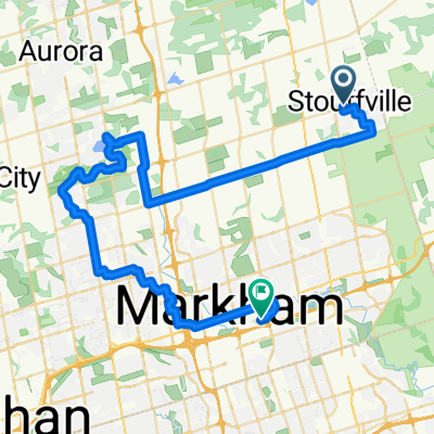 Stouffville to Unionville Via Lake Wilcox and Oak Ridges Trail
- Distance
- 57.4 km
- Ascent
- 257 m
- Descent
- 354 m
- Location
- Markham, Ontario, Canada
 Riviera Drive to Guildwood Parkway
- Distance
- 38.8 km
- Ascent
- 258 m
- Descent
- 324 m
- Location
- Markham, Ontario, Canada
 Stouffville to Unionville Via Lake Wilcox and Oak Ridges Trail
- Distance
- 55.8 km
- Ascent
- 253 m
- Descent
- 350 m
- Location
- Markham, Ontario, Canada
Open it in the app