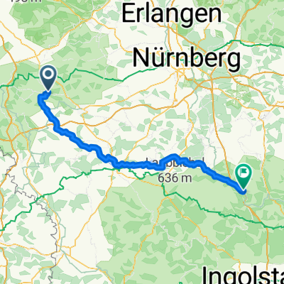
Altmühltal Radweg Rothenburg Kelheim
A cycling route starting in Colmberg, Bavaria, Germany.
Overview
About this route
from Gunzenhausen very beautiful (cloned from route 918810) (cloned from route 2977131)
- -:--
- Duration
- 211.7 km
- Distance
- 180 m
- Ascent
- 277 m
- Descent
- ---
- Avg. speed
- ---
- Max. altitude
Route quality
Waytypes & surfaces along the route
Waytypes
Track
97.4 km
(46 %)
Quiet road
55 km
(26 %)
Surfaces
Paved
144 km
(68 %)
Unpaved
44.5 km
(21 %)
Asphalt
133.4 km
(63 %)
Gravel
25.4 km
(12 %)
Continue with Bikemap
Use, edit, or download this cycling route
You would like to ride Altmühltal Radweg Rothenburg Kelheim or customize it for your own trip? Here is what you can do with this Bikemap route:
Free features
- Save this route as favorite or in collections
- Copy & plan your own version of this route
- Split it into stages to create a multi-day tour
- Sync your route with Garmin or Wahoo
Premium features
Free trial for 3 days, or one-time payment. More about Bikemap Premium.
- Navigate this route on iOS & Android
- Export a GPX / KML file of this route
- Create your custom printout (try it for free)
- Download this route for offline navigation
Discover more Premium features.
Get Bikemap PremiumFrom our community
Other popular routes starting in Colmberg
Colmberg-Eichstätt- Distance
- 117.2 km
- Ascent
- 114 m
- Descent
- 104 m
- Location
- Colmberg, Bavaria, Germany
2023 Tag 11 Dinkelsbühl- Distance
- 47.4 km
- Ascent
- 334 m
- Descent
- 338 m
- Location
- Colmberg, Bavaria, Germany
HE03-Colmberg-Pappenheim- Distance
- 76.6 km
- Ascent
- 94 m
- Descent
- 135 m
- Location
- Colmberg, Bavaria, Germany
Binzwangen-Ansbach 24km 70hm- Distance
- 23.8 km
- Ascent
- 110 m
- Descent
- 142 m
- Location
- Colmberg, Bavaria, Germany
Altmühltal Radweg Rothenburg Kelheim- Distance
- 211.7 km
- Ascent
- 180 m
- Descent
- 277 m
- Location
- Colmberg, Bavaria, Germany
Burgstraße, Colmberg nach Weinmarkt, Dinkelsbühl- Distance
- 49 km
- Ascent
- 255 m
- Descent
- 309 m
- Location
- Colmberg, Bavaria, Germany
Rundkurs Europäische Wasserscheide- Distance
- 58.6 km
- Ascent
- 465 m
- Descent
- 465 m
- Location
- Colmberg, Bavaria, Germany
Rund um Colmberg- Distance
- 37.2 km
- Ascent
- 177 m
- Descent
- 176 m
- Location
- Colmberg, Bavaria, Germany
Open it in the app

