

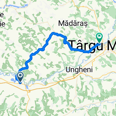
Călatorie in ținutul Târnavelor
A cycling route starting in Iernut, Mureș County, Romania.
Overview
About this route
O călătorie prin vechile sate ale ținutului Târnavelor
- -:--
- Duration
- 29.2 km
- Distance
- 388 m
- Ascent
- 323 m
- Descent
- ---
- Avg. speed
- ---
- Max. altitude

Route quality
Waytypes & surfaces along the route
Waytypes
Busy road
25 km
(86 %)
Quiet road
3 km
(10 %)
Surfaces
Paved
29.2 km
(100 %)
Unpaved
0 km
(<1 %)
Asphalt
29.2 km
(100 %)
Gravel
0 km
(<1 %)
Continue with Bikemap
Use, edit, or download this cycling route
You would like to ride Călatorie in ținutul Târnavelor or customize it for your own trip? Here is what you can do with this Bikemap route:
Free features
- Save this route as favorite or in collections
- Copy & plan your own version of this route
- Sync your route with Garmin or Wahoo
Premium features
Free trial for 3 days, or one-time payment. More about Bikemap Premium.
- Navigate this route on iOS & Android
- Export a GPX / KML file of this route
- Create your custom printout (try it for free)
- Download this route for offline navigation
Discover more Premium features.
Get Bikemap PremiumFrom our community
Other popular routes starting in Iernut
 BG22 Iernut-Cluj
- Distance
- 103.2 km
- Ascent
- 1,158 m
- Descent
- 1,096 m
- Location
- Iernut, Mureș County, Romania
 I_N
I_N- Distance
- 41.4 km
- Ascent
- 245 m
- Descent
- 214 m
- Location
- Iernut, Mureș County, Romania
 Discover Mures County
- Distance
- 83 km
- Ascent
- 223 m
- Descent
- 227 m
- Location
- Iernut, Mureș County, Romania
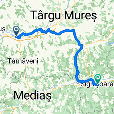 Iernut - Sighisoara ( leg III )
- Distance
- 87.1 km
- Ascent
- 422 m
- Descent
- 352 m
- Location
- Iernut, Mureș County, Romania
 Descopera Transilvania
- Distance
- 49.6 km
- Ascent
- 297 m
- Descent
- 305 m
- Location
- Iernut, Mureș County, Romania
 Strada Avram Iancu 52, Iernut - Strada Ion Luca Caragiale 10, Târgu Mureș
- Distance
- 34.3 km
- Ascent
- 145 m
- Descent
- 114 m
- Location
- Iernut, Mureș County, Romania
 Iernut-Cuci
- Distance
- 18.8 km
- Ascent
- 61 m
- Descent
- 63 m
- Location
- Iernut, Mureș County, Romania
 Călatorie in ținutul Târnavelor
- Distance
- 29.2 km
- Ascent
- 388 m
- Descent
- 323 m
- Location
- Iernut, Mureș County, Romania
Open it in the app