

Asbach-Rennsteig
A cycling route starting in Rotterode, Thuringia, Germany.
Overview
About this route
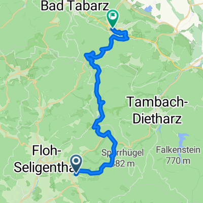
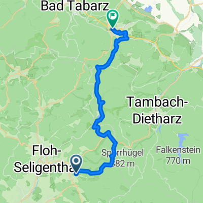
Von Asbach zum Rennsteig (Sperrhügel
- -:--
- Duration
- 6.8 km
- Distance
- 528 m
- Ascent
- 116 m
- Descent
- ---
- Avg. speed
- ---
- Max. altitude

Route quality
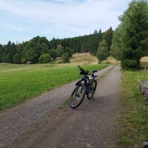
Waytypes & surfaces along the route
Waytypes
Track
6.7 km
(98 %)
Path
0.1 km
(2 %)
Access road
0 km
(<1 %)
Surfaces
Unpaved
4.9 km
(71 %)
Ground
4.3 km
(63 %)
Unpaved (undefined)
0.5 km
(7 %)
Continue with Bikemap
Use, edit, or download this cycling route
You would like to ride Asbach-Rennsteig or customize it for your own trip? Here is what you can do with this Bikemap route:
Free features
- Save this route as favorite or in collections
- Copy & plan your own version of this route
- Sync your route with Garmin or Wahoo
Premium features
Free trial for 3 days, or one-time payment. More about Bikemap Premium.
- Navigate this route on iOS & Android
- Export a GPX / KML file of this route
- Create your custom printout (try it for free)
- Download this route for offline navigation
Discover more Premium features.
Get Bikemap PremiumFrom our community
Other popular routes starting in Rotterode
 Rotterode-Erfurt 95 km
- Distance
- 90.2 km
- Ascent
- 597 m
- Descent
- 929 m
- Location
- Rotterode, Thuringia, Germany
 An den Birken 2, Floh-Seligenthal nach An den Birken 2, Floh-Seligenthal
- Distance
- 15.1 km
- Ascent
- 402 m
- Descent
- 449 m
- Location
- Rotterode, Thuringia, Germany
 Heidenstein, Floh-Seligenthal nach Burchardtsweg, Friedrichroda
- Distance
- 27.6 km
- Ascent
- 779 m
- Descent
- 817 m
- Location
- Rotterode, Thuringia, Germany
 Heidenstein 39, Floh-Seligenthal nach An den Birken 2, Floh-Seligenthal
- Distance
- 11.6 km
- Ascent
- 282 m
- Descent
- 323 m
- Location
- Rotterode, Thuringia, Germany
 Heidenstein 53, Floh-Seligenthal nach Straße ohne Straßennamen, Floh-Seligenthal
- Distance
- 3.5 km
- Ascent
- 276 m
- Descent
- 0 m
- Location
- Rotterode, Thuringia, Germany
 Heidenstein, Floh-Seligenthal nach Burchardtsweg, Friedrichroda
- Distance
- 23.9 km
- Ascent
- 623 m
- Descent
- 662 m
- Location
- Rotterode, Thuringia, Germany
 Rotterode-Wachsenrasen-Oberschönau (11 km)
- Distance
- 11.1 km
- Ascent
- 286 m
- Descent
- 365 m
- Location
- Rotterode, Thuringia, Germany
 Heidenstein nach An den Birken
- Distance
- 14.5 km
- Ascent
- 356 m
- Descent
- 402 m
- Location
- Rotterode, Thuringia, Germany
Open it in the app