

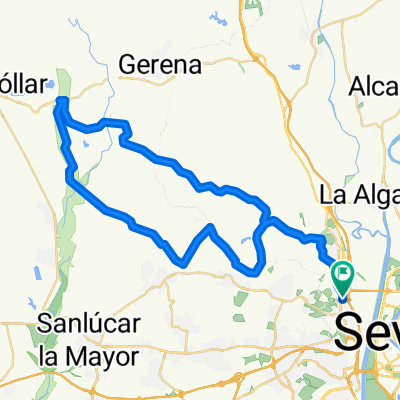
Sevilla-Santiponce-Arroyo del Judío-Valencina-Castilleja Guzmán-Cerro Sta Brígida-Camas-Sevilla
A cycling route starting in Camas, Andalusia, Spain.
Overview
About this route
Nice ride with monuments along the route and a good view of Seville at its final stretch.
- -:--
- Duration
- 30.3 km
- Distance
- 229 m
- Ascent
- 230 m
- Descent
- ---
- Avg. speed
- ---
- Max. altitude
Route quality
Waytypes & surfaces along the route
Waytypes
Track
11.8 km
(39 %)
Quiet road
7.6 km
(25 %)
Surfaces
Paved
9.1 km
(30 %)
Unpaved
12.1 km
(40 %)
Asphalt
8.5 km
(28 %)
Ground
7 km
(23 %)
Route highlights
Points of interest along the route
Point of interest after 7.1 km
Monasterio de San Isidoro del Campo
Point of interest after 8.1 km
Teatro de Itálica
Point of interest after 8.5 km
Termas Menores de Itálica
Point of interest after 10 km
Termas Mayores de Itálica
Point of interest after 19.9 km
Dolmen de La Pastora
Point of interest after 20.9 km
Dolmen de Montelirio
Continue with Bikemap
Use, edit, or download this cycling route
You would like to ride Sevilla-Santiponce-Arroyo del Judío-Valencina-Castilleja Guzmán-Cerro Sta Brígida-Camas-Sevilla or customize it for your own trip? Here is what you can do with this Bikemap route:
Free features
- Save this route as favorite or in collections
- Copy & plan your own version of this route
- Sync your route with Garmin or Wahoo
Premium features
Free trial for 3 days, or one-time payment. More about Bikemap Premium.
- Navigate this route on iOS & Android
- Export a GPX / KML file of this route
- Create your custom printout (try it for free)
- Download this route for offline navigation
Discover more Premium features.
Get Bikemap PremiumFrom our community
Other popular routes starting in Camas
 Sevilla-Santiponce-Arroyo del Judío-Valencina-Castilleja Guzmán-Cerro Sta Brígida-Camas-Sevilla
- Distance
- 30.9 km
- Ascent
- 265 m
- Descent
- 265 m
- Location
- Camas, Andalusia, Spain
 Guillenazo desde Camas
- Distance
- 86.8 km
- Ascent
- 587 m
- Descent
- 588 m
- Location
- Camas, Andalusia, Spain
 VUELTA A LA RIVERA
- Distance
- 148.6 km
- Ascent
- 925 m
- Descent
- 926 m
- Location
- Camas, Andalusia, Spain
 Sevilla - Carmona
- Distance
- 43 km
- Ascent
- 239 m
- Descent
- 23 m
- Location
- Camas, Andalusia, Spain
 USS KOBAYASHI MARU(GEOCACHING)-EL ARAL
- Distance
- 13.6 km
- Ascent
- 21 m
- Descent
- 21 m
- Location
- Camas, Andalusia, Spain
 Via Verde Itálica
- Distance
- 28.9 km
- Ascent
- 112 m
- Descent
- 45 m
- Location
- Camas, Andalusia, Spain
 Sevilla-Santiponce-Arroyo del Judío-Valencina-Castilleja Guzmán-Cerro Sta Brígida-Camas-Sevilla
- Distance
- 30.3 km
- Ascent
- 229 m
- Descent
- 230 m
- Location
- Camas, Andalusia, Spain
 camas-corredor verde-aznalcollar-camas
- Distance
- 56.5 km
- Ascent
- 335 m
- Descent
- 318 m
- Location
- Camas, Andalusia, Spain
Open it in the app