

Schladming Panoramarunde
A cycling route starting in Schladming, Styria, Austria.
Overview
About this route
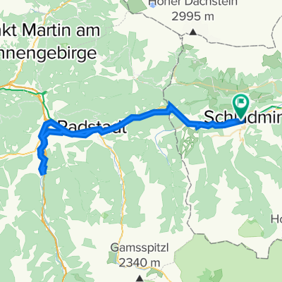
Very nice circular route towards the Dachstein region. The start is in Schladming at the Planaistadion, from where it initially follows the cycling path towards Lehen. At the railway crossing, a short ascent begins into the idyllic village of Birnberg. Through forest roads and a field path, one reaches Strimitzen, where a short but selective descent begins towards the state road near Lodenwalker. After the climb towards the parking area of Silberkarklamm, one rides along the hiking path through the forest to Ramsau-Rössing and further on the state road to Kulm. At the forge, the 'Philosophers' Path' begins, adorned with some root stumps, which leads directly to the ski jump complex in Ramsau-Ort. In the district of Schildlehen, the ascent of approximately 5.5 km begins up to Türlwand, where the valley station of the Dachstein Glacier cable car is located. After beautiful views of the impressive Dachstein massif, a short descent begins on the toll road until the turnoff at the mountain hut village 'Neustadt Alm'. From there, it continues on forest roads and field paths at the foot of the Dachstein towards Bachlalm, where, with a bit of luck, one can observe marmots. After descending on the closed road, one pedals again on the state road towards Ramsau. At the Auwirt turnoff, the descent to Grahsteg begins. A forest road leads towards Filzmoos, before a short, steep ascent begins at Km 39.8. After a final glance at the Dachstein massif, the descent to Mandling begins. There, the path merges into the R7, on which one can comfortably return to the starting point of the tour – to Schladming.
- -:--
- Duration
- 54.9 km
- Distance
- 1,163 m
- Ascent
- 1,162 m
- Descent
- ---
- Avg. speed
- ---
- Max. altitude
Continue with Bikemap
Use, edit, or download this cycling route
You would like to ride Schladming Panoramarunde or customize it for your own trip? Here is what you can do with this Bikemap route:
Free features
- Save this route as favorite or in collections
- Copy & plan your own version of this route
- Sync your route with Garmin or Wahoo
Premium features
Free trial for 3 days, or one-time payment. More about Bikemap Premium.
- Navigate this route on iOS & Android
- Export a GPX / KML file of this route
- Create your custom printout (try it for free)
- Download this route for offline navigation
Discover more Premium features.
Get Bikemap PremiumFrom our community
Other popular routes starting in Schladming
 Schladming Bergstation Planei ins Tal
- Distance
- 36.8 km
- Ascent
- 419 m
- Descent
- 1,501 m
- Location
- Schladming, Styria, Austria
 Rohrmoos Tour
- Distance
- 26.4 km
- Ascent
- 505 m
- Descent
- 504 m
- Location
- Schladming, Styria, Austria
 Top 6 Schladming 08 medium
- Distance
- 47.4 km
- Ascent
- 1,654 m
- Descent
- 1,661 m
- Location
- Schladming, Styria, Austria
 Planai
- Distance
- 17.9 km
- Ascent
- 1,105 m
- Descent
- 96 m
- Location
- Schladming, Styria, Austria
 Ennstalrunde
- Distance
- 67.7 km
- Ascent
- 608 m
- Descent
- 609 m
- Location
- Schladming, Styria, Austria
 Einrollen Ramsau 21.07.2014
- Distance
- 26.7 km
- Ascent
- 432 m
- Descent
- 432 m
- Location
- Schladming, Styria, Austria
 Schladming Flachau Rundweg
- Distance
- 61.3 km
- Ascent
- 224 m
- Descent
- 223 m
- Location
- Schladming, Styria, Austria
 Ramsau Tuerlwand
- Distance
- 32.8 km
- Ascent
- 1,350 m
- Descent
- 1,350 m
- Location
- Schladming, Styria, Austria
Open it in the app