

Parco dei Cedri - Monte delle Formiche
A cycling route starting in San Lazzaro di Savena, Emilia-Romagna, Italy.
Overview
About this route
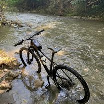
Route with progressive ascent, and the last 7 km steep.
- -:--
- Duration
- 52.6 km
- Distance
- 589 m
- Ascent
- 589 m
- Descent
- ---
- Avg. speed
- ---
- Max. altitude

Route quality
Waytypes & surfaces along the route
Waytypes
Road
36.8 km
(70 %)
Quiet road
12.6 km
(24 %)
Surfaces
Paved
42.6 km
(81 %)
Asphalt
42.6 km
(81 %)
Undefined
10 km
(19 %)
Continue with Bikemap
Use, edit, or download this cycling route
You would like to ride Parco dei Cedri - Monte delle Formiche or customize it for your own trip? Here is what you can do with this Bikemap route:
Free features
- Save this route as favorite or in collections
- Copy & plan your own version of this route
- Sync your route with Garmin or Wahoo
Premium features
Free trial for 3 days, or one-time payment. More about Bikemap Premium.
- Navigate this route on iOS & Android
- Export a GPX / KML file of this route
- Create your custom printout (try it for free)
- Download this route for offline navigation
Discover more Premium features.
Get Bikemap PremiumFrom our community
Other popular routes starting in San Lazzaro di Savena
 Parco dei Cedri - Monte delle Formiche
- Distance
- 52.6 km
- Ascent
- 589 m
- Descent
- 589 m
- Location
- San Lazzaro di Savena, Emilia-Romagna, Italy
 Raticosa at the end...
- Distance
- 87.6 km
- Ascent
- 1,016 m
- Descent
- 1,017 m
- Location
- San Lazzaro di Savena, Emilia-Romagna, Italy
 Bo-Fi-Bo
- Distance
- 222.7 km
- Ascent
- 4,415 m
- Descent
- 4,413 m
- Location
- San Lazzaro di Savena, Emilia-Romagna, Italy
 Botteghino di Zocca
- Distance
- 26.9 km
- Ascent
- 569 m
- Descent
- 571 m
- Location
- San Lazzaro di Savena, Emilia-Romagna, Italy
 Bo-C.S.Pietro-Liano-Bo
- Distance
- 55.2 km
- Ascent
- 259 m
- Descent
- 261 m
- Location
- San Lazzaro di Savena, Emilia-Romagna, Italy
 gaibola
- Distance
- 17 km
- Ascent
- 276 m
- Descent
- 271 m
- Location
- San Lazzaro di Savena, Emilia-Romagna, Italy
 Modena
- Distance
- 53.5 km
- Ascent
- 146 m
- Descent
- 154 m
- Location
- San Lazzaro di Savena, Emilia-Romagna, Italy
 2 febbraio 2020
- Distance
- 83.9 km
- Ascent
- 927 m
- Descent
- 928 m
- Location
- San Lazzaro di Savena, Emilia-Romagna, Italy
Open it in the app