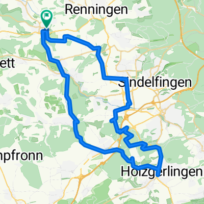
Short Workout
A cycling route starting in Weil der Stadt, Baden-Württemberg, Germany.
Overview
About this route
Just a short loop in the Weil der Stadt area
There is an alternative route if you require paved surfaces. The default route contains a short section that goes straight accross a field.- -:--
- Duration
- 22.5 km
- Distance
- 141 m
- Ascent
- 141 m
- Descent
- ---
- Avg. speed
- ---
- Avg. speed
Route quality
Waytypes & surfaces along the route
Waytypes
Track
15.5 km
(69 %)
Quiet road
3.9 km
(17 %)
Surfaces
Paved
21.3 km
(95 %)
Unpaved
0.7 km
(3 %)
Asphalt
19.6 km
(87 %)
Paved (undefined)
1.7 km
(7 %)
Route highlights
Points of interest along the route
Point of interest after 12.2 km
Go left here if you want only paved surfaces
Point of interest after 13.4 km
Cross the field / meadow
Continue with Bikemap
Use, edit, or download this cycling route
You would like to ride Short Workout or customize it for your own trip? Here is what you can do with this Bikemap route:
Free features
- Save this route as favorite or in collections
- Copy & plan your own version of this route
- Sync your route with Garmin or Wahoo
Premium features
Free trial for 3 days, or one-time payment. More about Bikemap Premium.
- Navigate this route on iOS & Android
- Export a GPX / KML file of this route
- Create your custom printout (try it for free)
- Download this route for offline navigation
Discover more Premium features.
Get Bikemap PremiumFrom our community
Other popular routes starting in Weil der Stadt
- Weil der Stadt - Bietigheim Rommelsmühle Glemstal - Enztal
- Distance
- 48.3 km
- Ascent
- 176 m
- Descent
- 395 m
- Location
- Weil der Stadt, Baden-Württemberg, Germany
- Avoid crossing major roads (WIP)
- Distance
- 52.9 km
- Ascent
- 447 m
- Descent
- 449 m
- Location
- Weil der Stadt, Baden-Württemberg, Germany
- 000_41km_17-Radler_WdStadt-Calw-Bad Liebenzell-Pforzheim
- Distance
- 41.8 km
- Ascent
- 321 m
- Descent
- 463 m
- Location
- Weil der Stadt, Baden-Württemberg, Germany
- Klettern im Nordschwarzwald
- Distance
- 126.1 km
- Ascent
- 2,975 m
- Descent
- 2,878 m
- Location
- Weil der Stadt, Baden-Württemberg, Germany
- Weil der Stadt - Bietigheim (via Würmtalradweg und Enztalradweg)
- Distance
- 77.1 km
- Ascent
- 203 m
- Descent
- 392 m
- Location
- Weil der Stadt, Baden-Württemberg, Germany
- Weil der Stadt Simmozheim Althengstett
- Distance
- 40 km
- Ascent
- 291 m
- Descent
- 303 m
- Location
- Weil der Stadt, Baden-Württemberg, Germany
- MTB | Wdst->Bad Liebenzell->Monbachtal->WdSt
- Distance
- 30.6 km
- Ascent
- 425 m
- Descent
- 427 m
- Location
- Weil der Stadt, Baden-Württemberg, Germany
- Nagoldtalrunde
- Distance
- 56.8 km
- Ascent
- 531 m
- Descent
- 531 m
- Location
- Weil der Stadt, Baden-Württemberg, Germany
Open it in the app