

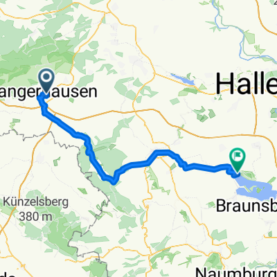
SGH 002: Sangerhausen - Hattorf
A cycling route starting in Sangerhausen, Saxony-Anhalt, Germany.
Overview
About this route
Sangerhausen - Hattorf
- -:--
- Duration
- 91 km
- Distance
- 333 m
- Ascent
- 371 m
- Descent
- ---
- Avg. speed
- ---
- Max. altitude
Route quality
Waytypes & surfaces along the route
Waytypes
Road
22.8 km
(25 %)
Path
18.2 km
(20 %)
Surfaces
Paved
74.6 km
(82 %)
Unpaved
0.9 km
(1 %)
Asphalt
70.1 km
(77 %)
Paved (undefined)
4.6 km
(5 %)
Route highlights
Points of interest along the route
Accommodation after 0 km
Hotel Am Rosarium
Accommodation after 2.9 km
Hotel/Rest. Weinberg
Continue with Bikemap
Use, edit, or download this cycling route
You would like to ride SGH 002: Sangerhausen - Hattorf or customize it for your own trip? Here is what you can do with this Bikemap route:
Free features
- Save this route as favorite or in collections
- Copy & plan your own version of this route
- Split it into stages to create a multi-day tour
- Sync your route with Garmin or Wahoo
Premium features
Free trial for 3 days, or one-time payment. More about Bikemap Premium.
- Navigate this route on iOS & Android
- Export a GPX / KML file of this route
- Create your custom printout (try it for free)
- Download this route for offline navigation
Discover more Premium features.
Get Bikemap PremiumFrom our community
Other popular routes starting in Sangerhausen
 Hausstrecke einfach
- Distance
- 23.1 km
- Ascent
- 150 m
- Descent
- 46 m
- Location
- Sangerhausen, Saxony-Anhalt, Germany
 Sangerhausen-Grillenberg-Waldbad
- Distance
- 10.6 km
- Ascent
- 88 m
- Descent
- 3 m
- Location
- Sangerhausen, Saxony-Anhalt, Germany
 4. Südharztour Sangerhausen
- Distance
- 84.2 km
- Ascent
- 765 m
- Descent
- 765 m
- Location
- Sangerhausen, Saxony-Anhalt, Germany
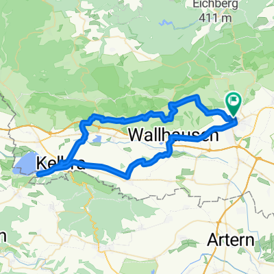
 Kyffhäuser und Goldene Aue-Tour, mittlere Schwierigkeit
- Distance
- 105.4 km
- Ascent
- 513 m
- Descent
- 513 m
- Location
- Sangerhausen, Saxony-Anhalt, Germany
 SGH 002: Sangerhausen - Hattorf
- Distance
- 91 km
- Ascent
- 333 m
- Descent
- 371 m
- Location
- Sangerhausen, Saxony-Anhalt, Germany
 Schloßberge, Sangerhausen nach Wasserwerk, Mücheln (Geiseltal)
- Distance
- 55.8 km
- Ascent
- 342 m
- Descent
- 408 m
- Location
- Sangerhausen, Saxony-Anhalt, Germany
 Roßla
Roßla- Distance
- 30.6 km
- Ascent
- 89 m
- Descent
- 95 m
- Location
- Sangerhausen, Saxony-Anhalt, Germany
 Route nach Südharz
- Distance
- 56.4 km
- Ascent
- 552 m
- Descent
- 553 m
- Location
- Sangerhausen, Saxony-Anhalt, Germany
Open it in the app