Kandel - Offenbach/Queich - Kandel
A cycling route starting in Minfeld, Rhineland-Palatinate, Germany.
Overview
About this route
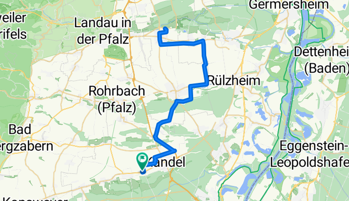
From Kandel to Offenbach/Queich including a small detour.
- -:--
- Duration
- 55 km
- Distance
- 149 m
- Ascent
- 142 m
- Descent
- ---
- Avg. speed
- 139 m
- Max. altitude
Route quality
Waytypes & surfaces along the route
Waytypes
Track
29.1 km
(53 %)
Quiet road
5.5 km
(10 %)
Surfaces
Paved
46.7 km
(85 %)
Unpaved
3.8 km
(7 %)
Asphalt
30.2 km
(55 %)
Paved (undefined)
10.4 km
(19 %)
Continue with Bikemap
Use, edit, or download this cycling route
You would like to ride Kandel - Offenbach/Queich - Kandel or customize it for your own trip? Here is what you can do with this Bikemap route:
Free features
- Save this route as favorite or in collections
- Copy & plan your own version of this route
- Sync your route with Garmin or Wahoo
Premium features
Free trial for 3 days, or one-time payment. More about Bikemap Premium.
- Navigate this route on iOS & Android
- Export a GPX / KML file of this route
- Create your custom printout (try it for free)
- Download this route for offline navigation
Discover more Premium features.
Get Bikemap PremiumFrom our community
Other popular routes starting in Minfeld
- Minfeld - Reisdorf - Minfeld
- Distance
- 50.9 km
- Ascent
- 380 m
- Descent
- 380 m
- Location
- Minfeld, Rhineland-Palatinate, Germany
- Südpfalz
- Distance
- 108.5 km
- Ascent
- 706 m
- Descent
- 706 m
- Location
- Minfeld, Rhineland-Palatinate, Germany
- Kandel-Bergz-Weissenb-Kandel
- Distance
- 50.8 km
- Ascent
- 382 m
- Descent
- 382 m
- Location
- Minfeld, Rhineland-Palatinate, Germany
- Kandel - Rheinhausen - Kandel
- Distance
- 99.6 km
- Ascent
- 205 m
- Descent
- 217 m
- Location
- Minfeld, Rhineland-Palatinate, Germany
- Schöne Südpfalz
- Distance
- 60.9 km
- Ascent
- 386 m
- Descent
- 384 m
- Location
- Minfeld, Rhineland-Palatinate, Germany
- Kandel - Mt. Blankenborn - Kandel
- Distance
- 58.2 km
- Ascent
- 327 m
- Descent
- 327 m
- Location
- Minfeld, Rhineland-Palatinate, Germany
- Kandel - Burg Andeck - Kandel
- Distance
- 52.8 km
- Ascent
- 421 m
- Descent
- 422 m
- Location
- Minfeld, Rhineland-Palatinate, Germany
- Kandel - Bergzabern - Silz - Kandel
- Distance
- 53.8 km
- Ascent
- 323 m
- Descent
- 321 m
- Location
- Minfeld, Rhineland-Palatinate, Germany
Open it in the app