

* BE. Vlaams Scheldewindeke-Muur van Geraardsbergen
A cycling route starting in Oosterzele, Flemish Region, Belgium.
Overview
About this route
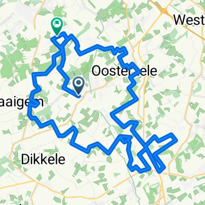
By car from Zierikzee to Scheldewindeke 111 km. Parking at Sporthal de Kluize. Through the Flemish countryside to Geraardsbergen to conquer the Kapelmuur.
The route, aside from the necessary connecting roads, mainly runs over low-traffic roads and paths reserved for cyclists. Besides the Muur, the course is largely 'cobblestone-free'.
- -:--
- Duration
- 64.7 km
- Distance
- 298 m
- Ascent
- 298 m
- Descent
- ---
- Avg. speed
- ---
- Max. altitude

Route quality
Waytypes & surfaces along the route
Waytypes
Quiet road
38.8 km
(60 %)
Road
15.5 km
(24 %)
Surfaces
Paved
26.5 km
(41 %)
Asphalt
16.8 km
(26 %)
Concrete
9.7 km
(15 %)
Undefined
38.2 km
(59 %)
Continue with Bikemap
Use, edit, or download this cycling route
You would like to ride * BE. Vlaams Scheldewindeke-Muur van Geraardsbergen or customize it for your own trip? Here is what you can do with this Bikemap route:
Free features
- Save this route as favorite or in collections
- Copy & plan your own version of this route
- Sync your route with Garmin or Wahoo
Premium features
Free trial for 3 days, or one-time payment. More about Bikemap Premium.
- Navigate this route on iOS & Android
- Export a GPX / KML file of this route
- Create your custom printout (try it for free)
- Download this route for offline navigation
Discover more Premium features.
Get Bikemap PremiumFrom our community
Other popular routes starting in Oosterzele
 * BE. Vlaams Scheldewindeke-Muur van Geraardsbergen
- Distance
- 64.7 km
- Ascent
- 298 m
- Descent
- 298 m
- Location
- Oosterzele, Flemish Region, Belgium
 Dender-Schelde
- Distance
- 57.2 km
- Ascent
- 215 m
- Descent
- 215 m
- Location
- Oosterzele, Flemish Region, Belgium
 Rodeland Route 2
- Distance
- 49.3 km
- Ascent
- 161 m
- Descent
- 162 m
- Location
- Oosterzele, Flemish Region, Belgium
 Langs bossen en meersen fietsroute
- Distance
- 48.3 km
- Ascent
- 196 m
- Descent
- 194 m
- Location
- Oosterzele, Flemish Region, Belgium
 Tom Bollegem
- Distance
- 48.4 km
- Ascent
- 173 m
- Descent
- 172 m
- Location
- Oosterzele, Flemish Region, Belgium
 Oosterzele
- Distance
- 30.9 km
- Ascent
- 113 m
- Descent
- 113 m
- Location
- Oosterzele, Flemish Region, Belgium
 Rekelberg-Leberg-Berendries
- Distance
- 70.4 km
- Ascent
- 301 m
- Descent
- 301 m
- Location
- Oosterzele, Flemish Region, Belgium
 Vissershof
- Distance
- 54 km
- Ascent
- 222 m
- Descent
- 221 m
- Location
- Oosterzele, Flemish Region, Belgium
Open it in the app