
Tour for Life - Etappe 7
A cycling route starting in Saint-Mihiel, Grand Est, France.
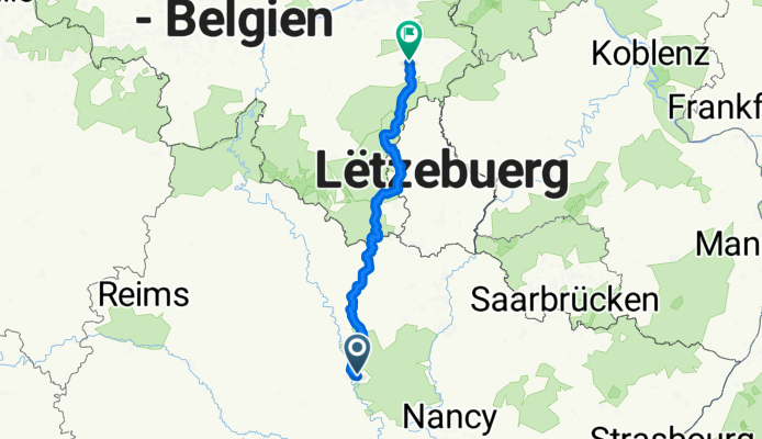
Overview
About this route
Etappe 7 Tour for Life 2011 - De langste etappe, maar liefst 225 kilometers, is een echte Ardennenklassieker! Je voelt de finish in Valkenburg steeds dichterbij komen. Bijzonder is dat je in één dag door Frankrijk, Luxemburg en België rijdt. In de buurt van Bastenaken krijg je de kans om een aantal beroemde hellingen van de wielerklassieker Luik-Bastenaken-Luik te beklimmen. Je rust uit op de camping in het Belgische Grand Halleux
- -:--
- Duration
- 223.7 km
- Distance
- 976 m
- Ascent
- 885 m
- Descent
- ---
- Avg. speed
- ---
- Max. altitude
Route quality
Waytypes & surfaces along the route
Waytypes
Busy road
75.8 km
(34 %)
Road
68.5 km
(31 %)
Surfaces
Paved
121.2 km
(54 %)
Unpaved
7 km
(3 %)
Asphalt
112.4 km
(50 %)
Paved (undefined)
7.5 km
(3 %)
Continue with Bikemap
Use, edit, or download this cycling route
You would like to ride Tour for Life - Etappe 7 or customize it for your own trip? Here is what you can do with this Bikemap route:
Free features
- Save this route as favorite or in collections
- Copy & plan your own version of this route
- Split it into stages to create a multi-day tour
- Sync your route with Garmin or Wahoo
Premium features
Free trial for 3 days, or one-time payment. More about Bikemap Premium.
- Navigate this route on iOS & Android
- Export a GPX / KML file of this route
- Create your custom printout (try it for free)
- Download this route for offline navigation
Discover more Premium features.
Get Bikemap PremiumFrom our community
Other popular routes starting in Saint-Mihiel
 22 RRRrrrrrrrr
- Distance
- 77.8 km
- Ascent
- 665 m
- Descent
- 611 m
- Location
- Saint-Mihiel, Grand Est, France
 62 km Ailly
- Distance
- 61.7 km
- Ascent
- 635 m
- Descent
- 600 m
- Location
- Saint-Mihiel, Grand Est, France
 Tour de Lorraine 4
- Distance
- 115.8 km
- Ascent
- 541 m
- Descent
- 471 m
- Location
- Saint-Mihiel, Grand Est, France
 46 km 520 m
- Distance
- 46.1 km
- Ascent
- 566 m
- Descent
- 570 m
- Location
- Saint-Mihiel, Grand Est, France
 RF Buxerulles to Villey le Sec
- Distance
- 52.9 km
- Ascent
- 309 m
- Descent
- 356 m
- Location
- Saint-Mihiel, Grand Est, France
 Tour for Life 2011 - Etappe 7
- Distance
- 223.7 km
- Ascent
- 1,001 m
- Descent
- 908 m
- Location
- Saint-Mihiel, Grand Est, France
 GP de Chauvencourt
- Distance
- 25.2 km
- Ascent
- 236 m
- Descent
- 230 m
- Location
- Saint-Mihiel, Grand Est, France
 Verdun_01
- Distance
- 166 km
- Ascent
- 821 m
- Descent
- 837 m
- Location
- Saint-Mihiel, Grand Est, France
Open it in the app