hotel cepina cancano passo trela val vezzola
- 48.6 km
- 1,259 m
- 1,259 m
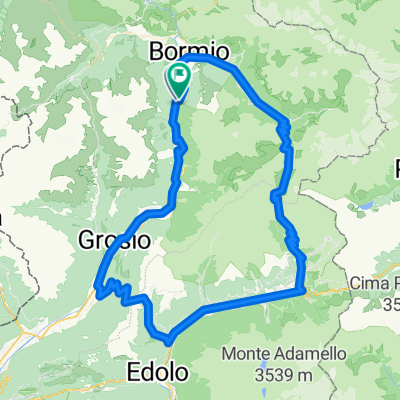
- Valdisotto, Lombardy, Italy
A cycling route starting in Valdisotto, Lombardy, Italy.
Overview
First, on the last section of the Sentiero Valtinella towards Bormio and the town center, where one can turn directly onto the Stilfeserjochstraße and begin the ascent. Initially, the road winds out of town in some serpentines and through a first tunnel uphill to a right turn, after which the road continues in further serpentines, through several tunnels and with occasionally significant incline towards a green slope, where one gains height quickly in a series of hairpin turns. Next is a long high valley, at the end of which one leaves the turnoff to the Umbrail Pass to the left and tackles the last three steep kilometers. At the top, there's hustle and bustle and the incomparable view of the Ortler massif with the descending serpentines in the foreground. During the following long descent, one can thoroughly enjoy this panorama before the road dives into the woods, only to reveal postcard-worthy sights again in the picturesque spot of Trafol. In the valley bottom, the ride continues downhill to Prad, where one can reach the Vinschgau cycling route along the Etsch via side roads. One follows this well-marked path, which from Laatsch features several significant and very unpleasant steep sections, until arriving at the camping site (with restaurant).
Fifteenth of twenty stages of a cycling tour around Switzerland. Completely focused on crossing the Stelvio on the breathtaking mountain road, this stage makes the additional ascent at the end, almost to the Reschen Pass, seem quite insignificant despite the effort it requires.
created this 10 years ago
Continue with Bikemap
You would like to ride (15) Cepina - S.Valentino alla Muta or customize it for your own trip? Here is what you can do with this Bikemap route:
Free trial for 3 days, or one-time payment. More about Bikemap Premium.
Discover more Premium features.
Get Bikemap PremiumFrom our community
Open it in the app