

Vars Pontis Jean
A cycling route starting in Barcelonnette, Provence-Alpes-Côte d'Azur Region, France.
Overview
About this route
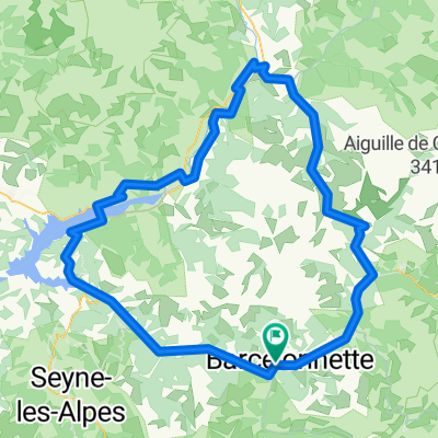
305 Col de Vars (2109 m) 303 Col de Pontis (1301 m)
- -:--
- Duration
- 122.3 km
- Distance
- 1,868 m
- Ascent
- 1,873 m
- Descent
- ---
- Avg. speed
- ---
- Max. altitude
Continue with Bikemap
Use, edit, or download this cycling route
You would like to ride Vars Pontis Jean or customize it for your own trip? Here is what you can do with this Bikemap route:
Free features
- Save this route as favorite or in collections
- Copy & plan your own version of this route
- Split it into stages to create a multi-day tour
- Sync your route with Garmin or Wahoo
Premium features
Free trial for 3 days, or one-time payment. More about Bikemap Premium.
- Navigate this route on iOS & Android
- Export a GPX / KML file of this route
- Create your custom printout (try it for free)
- Download this route for offline navigation
Discover more Premium features.
Get Bikemap PremiumFrom our community
Other popular routes starting in Barcelonnette
 Allauch 22 Tag 10 Do 9.6.
- Distance
- 89.6 km
- Ascent
- 2,035 m
- Descent
- 2,501 m
- Location
- Barcelonnette, Provence-Alpes-Côte d'Azur Region, France
 Allauch 8. Etappe
- Distance
- 92.5 km
- Ascent
- 1,242 m
- Descent
- 1,623 m
- Location
- Barcelonnette, Provence-Alpes-Côte d'Azur Region, France
 Tour du Mercantour (remorque, solo)
- Distance
- 436.6 km
- Ascent
- 8,033 m
- Descent
- 8,036 m
- Location
- Barcelonnette, Provence-Alpes-Côte d'Azur Region, France
 Tord de France 2008 - Tag 3 Col De La Bonette
- Distance
- 66.5 km
- Ascent
- 1,558 m
- Descent
- 1,558 m
- Location
- Barcelonnette, Provence-Alpes-Côte d'Azur Region, France
 FR Alpes Circuit des 3 Cols
- Distance
- 116.8 km
- Ascent
- 3,133 m
- Descent
- 3,133 m
- Location
- Barcelonnette, Provence-Alpes-Côte d'Azur Region, France
 Barcelonnette (Uvernet-Fours) - Bayasse
- Distance
- 20.7 km
- Ascent
- 1,049 m
- Descent
- 403 m
- Location
- Barcelonnette, Provence-Alpes-Côte d'Azur Region, France
 Route in La Condamine-Châtelard
- Distance
- 140.2 km
- Ascent
- 5,301 m
- Descent
- 5,303 m
- Location
- Barcelonnette, Provence-Alpes-Côte d'Azur Region, France
 Vars Pontis Jean
- Distance
- 122.3 km
- Ascent
- 1,868 m
- Descent
- 1,873 m
- Location
- Barcelonnette, Provence-Alpes-Côte d'Azur Region, France
Open it in the app