

RTC Trankiejement Andalucia
AndenLucia 4a Guadix Órgiva
A cycling route starting in Guadix, Andalusia, Spain.
Overview
About this route
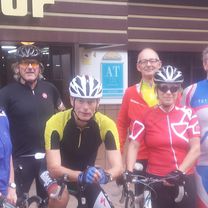
Today, Saturday, October 10, we have the choice to go 'below' to Órgiva.
- -:--
- Duration
- 108.7 km
- Distance
- 1,841 m
- Ascent
- 2,278 m
- Descent
- ---
- Avg. speed
- ---
- Max. altitude

Part of
RTC Trankiejement Andalucia
10 stages
Route quality
Waytypes & surfaces along the route
Waytypes
Road
9.8 km
(9 %)
Track
5.4 km
(5 %)
Surfaces
Paved
101.1 km
(93 %)
Unpaved
3.3 km
(3 %)
Asphalt
97.8 km
(90 %)
Paved (undefined)
3.3 km
(3 %)
Continue with Bikemap
Use, edit, or download this cycling route
You would like to ride AndenLucia 4a Guadix Órgiva or customize it for your own trip? Here is what you can do with this Bikemap route:
Free features
- Save this route as favorite or in collections
- Copy & plan your own version of this route
- Split it into stages to create a multi-day tour
- Sync your route with Garmin or Wahoo
Premium features
Free trial for 3 days, or one-time payment. More about Bikemap Premium.
- Navigate this route on iOS & Android
- Export a GPX / KML file of this route
- Create your custom printout (try it for free)
- Download this route for offline navigation
Discover more Premium features.
Get Bikemap PremiumFrom our community
Other popular routes starting in Guadix
 Guadix - Huélago - El Maleno - Moreda - Piñar
- Distance
- 52.2 km
- Ascent
- 345 m
- Descent
- 351 m
- Location
- Guadix, Andalusia, Spain
 Guadix - Baños de Alicún - Parque megalítico de Dólmenes
- Distance
- 43.8 km
- Ascent
- 500 m
- Descent
- 331 m
- Location
- Guadix, Andalusia, Spain
 Guadix - vuelta chica - Pno Fco Abellán - Baños Graena - Beas - Policar
- Distance
- 45.9 km
- Ascent
- 728 m
- Descent
- 472 m
- Location
- Guadix, Andalusia, Spain
 BTT GUADIX ALMERIA
- Distance
- 102.8 km
- Ascent
- 376 m
- Descent
- 1,267 m
- Location
- Guadix, Andalusia, Spain
 Guadix - La Calahorra - Mirador de Aldeire
- Distance
- 34 km
- Ascent
- 742 m
- Descent
- 107 m
- Location
- Guadix, Andalusia, Spain
 Guadix - Puerto de la Ragua - Bayarcal
- Distance
- 56.3 km
- Ascent
- 1,251 m
- Descent
- 892 m
- Location
- Guadix, Andalusia, Spain
 2ª etapa Alpujarra2009.
- Distance
- 76.6 km
- Ascent
- 1,705 m
- Descent
- 1,623 m
- Location
- Guadix, Andalusia, Spain
 Guadix - Albuñan - La Calahorra - Estación de Charches
- Distance
- 39.5 km
- Ascent
- 413 m
- Descent
- 208 m
- Location
- Guadix, Andalusia, Spain
Open it in the app