

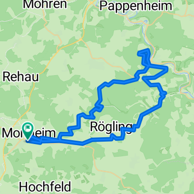
Altmühltal-Runde, ca. 70 km, teilweise schwer
A cycling route starting in Monheim, Bavaria, Germany.
Overview
About this route
Mohnheim - Warching - Altendorf - Altendorf - Solnhofen - Pappenheim - Treuchtlingen - Treuchtlingen - Wolferstadt - Wemding - Wemding - Mohnheim
- -:--
- Duration
- 66.6 km
- Distance
- 668 m
- Ascent
- 659 m
- Descent
- ---
- Avg. speed
- ---
- Max. altitude

Route quality
Waytypes & surfaces along the route
Waytypes
Quiet road
26.8 km
(40 %)
Road
16.2 km
(24 %)
Surfaces
Paved
36 km
(54 %)
Unpaved
9.8 km
(15 %)
Asphalt
33.1 km
(50 %)
Gravel
8.9 km
(13 %)
Continue with Bikemap
Use, edit, or download this cycling route
You would like to ride Altmühltal-Runde, ca. 70 km, teilweise schwer or customize it for your own trip? Here is what you can do with this Bikemap route:
Free features
- Save this route as favorite or in collections
- Copy & plan your own version of this route
- Sync your route with Garmin or Wahoo
Premium features
Free trial for 3 days, or one-time payment. More about Bikemap Premium.
- Navigate this route on iOS & Android
- Export a GPX / KML file of this route
- Create your custom printout (try it for free)
- Download this route for offline navigation
Discover more Premium features.
Get Bikemap PremiumFrom our community
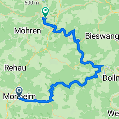
Other popular routes starting in Monheim
 Mittelfrankenritt
- Distance
- 66.7 km
- Ascent
- 836 m
- Descent
- 819 m
- Location
- Monheim, Bavaria, Germany
 Monheim - Altmühltal ..."best off"
- Distance
- 92.4 km
- Ascent
- 1,107 m
- Descent
- 1,108 m
- Location
- Monheim, Bavaria, Germany
 Monheimer-Alb-Runde
- Distance
- 62.2 km
- Ascent
- 374 m
- Descent
- 372 m
- Location
- Monheim, Bavaria, Germany
 Falbental
- Distance
- 69.8 km
- Ascent
- 535 m
- Descent
- 546 m
- Location
- Monheim, Bavaria, Germany
 Altmühltal-Runde, ca. 70 km, teilweise schwer
- Distance
- 66.6 km
- Ascent
- 668 m
- Descent
- 659 m
- Location
- Monheim, Bavaria, Germany
 Ostersonntag2020
- Distance
- 43.1 km
- Ascent
- 999 m
- Descent
- 998 m
- Location
- Monheim, Bavaria, Germany
 Langsame Fahrt in Treuchtlingen
- Distance
- 18 km
- Ascent
- 130 m
- Descent
- 237 m
- Location
- Monheim, Bavaria, Germany
 Neuburger Straße 3, Monheim nach Hauptstraße 46, Treuchtlingen
- Distance
- 40.1 km
- Ascent
- 561 m
- Descent
- 690 m
- Location
- Monheim, Bavaria, Germany
Open it in the app