

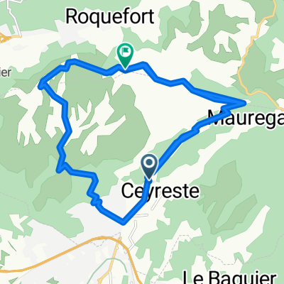
La Ciotat-Route des Crètes-27km-490hm
A cycling route starting in Ceyreste, Provence-Alpes-Côte d'Azur Region, France.
Overview
About this route
Short and to the point, see the elevation profile (350m of ascent over 5km) Highlights:
- The cliff drops 350m vertically into the sea.
(cloned from route 1618725)
- -:--
- Duration
- 27.1 km
- Distance
- 486 m
- Ascent
- 483 m
- Descent
- ---
- Avg. speed
- ---
- Max. altitude
Continue with Bikemap
Use, edit, or download this cycling route
You would like to ride La Ciotat-Route des Crètes-27km-490hm or customize it for your own trip? Here is what you can do with this Bikemap route:
Free features
- Save this route as favorite or in collections
- Copy & plan your own version of this route
- Sync your route with Garmin or Wahoo
Premium features
Free trial for 3 days, or one-time payment. More about Bikemap Premium.
- Navigate this route on iOS & Android
- Export a GPX / KML file of this route
- Create your custom printout (try it for free)
- Download this route for offline navigation
Discover more Premium features.
Get Bikemap PremiumFrom our community
Other popular routes starting in Ceyreste
 La Ciotat-Route des Crètes-27km-490hm
- Distance
- 27.1 km
- Ascent
- 463 m
- Descent
- 463 m
- Location
- Ceyreste, Provence-Alpes-Côte d'Azur Region, France
 La Ciotat-Route des Crètes-27km-490hm
- Distance
- 27.1 km
- Ascent
- 486 m
- Descent
- 483 m
- Location
- Ceyreste, Provence-Alpes-Côte d'Azur Region, France
 magnifique parcours a Ceyreste,
- Distance
- 34.6 km
- Ascent
- 1,241 m
- Descent
- 912 m
- Location
- Ceyreste, Provence-Alpes-Côte d'Azur Region, France
 La route des crêtes et des vignobles (La Ciotat)
- Distance
- 74.8 km
- Ascent
- 1,502 m
- Descent
- 1,500 m
- Location
- Ceyreste, Provence-Alpes-Côte d'Azur Region, France
 "Le Grand Caunet"
- Distance
- 35 km
- Ascent
- 468 m
- Descent
- 468 m
- Location
- Ceyreste, Provence-Alpes-Côte d'Azur Region, France
 faron ccol de garde
- Distance
- 85.3 km
- Ascent
- 1,147 m
- Descent
- 1,147 m
- Location
- Ceyreste, Provence-Alpes-Côte d'Azur Region, France
 cassis- giens projet
- Distance
- 92.9 km
- Ascent
- 532 m
- Descent
- 528 m
- Location
- Ceyreste, Provence-Alpes-Côte d'Azur Region, France
 Ceyreste-D3D-Ceyreste
- Distance
- 30.7 km
- Ascent
- 520 m
- Descent
- 520 m
- Location
- Ceyreste, Provence-Alpes-Côte d'Azur Region, France
Open it in the app