

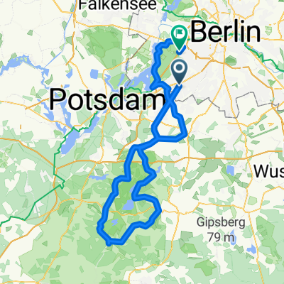
Zehlendorf-Teufelssee-Havelchaussee-Zehlendorf
A cycling route starting in Zehlendorf, Land Berlin, Germany.
Overview
About this route
Zehlendorf-Teufelssee-Havelchaussee-Zehlendorf
- -:--
- Duration
- 23.9 km
- Distance
- 125 m
- Ascent
- 126 m
- Descent
- ---
- Avg. speed
- ---
- Avg. speed

Route quality
Waytypes & surfaces along the route
Waytypes
Road
13 km
(54 %)
Track
4.4 km
(18 %)
Surfaces
Paved
16.4 km
(69 %)
Unpaved
7.1 km
(30 %)
Asphalt
16.3 km
(68 %)
Gravel
3.2 km
(13 %)
Continue with Bikemap
Use, edit, or download this cycling route
You would like to ride Zehlendorf-Teufelssee-Havelchaussee-Zehlendorf or customize it for your own trip? Here is what you can do with this Bikemap route:
Free features
- Save this route as favorite or in collections
- Copy & plan your own version of this route
- Sync your route with Garmin or Wahoo
Premium features
Free trial for 3 days, or one-time payment. More about Bikemap Premium.
- Navigate this route on iOS & Android
- Export a GPX / KML file of this route
- Create your custom printout (try it for free)
- Download this route for offline navigation
Discover more Premium features.
Get Bikemap PremiumFrom our community
Other popular routes starting in Zehlendorf
 Dahlem Route
- Distance
- 15.8 km
- Ascent
- 49 m
- Descent
- 52 m
- Location
- Zehlendorf, Land Berlin, Germany
 grunerunde
- Distance
- 31.4 km
- Ascent
- 181 m
- Descent
- 178 m
- Location
- Zehlendorf, Land Berlin, Germany
 S Zehlendorf -> Tremsdorf -> Caputh -> Auerbachtunnel
- Distance
- 65.4 km
- Ascent
- 258 m
- Descent
- 245 m
- Location
- Zehlendorf, Land Berlin, Germany
 Dobbrikow andersrum
- Distance
- 111.2 km
- Ascent
- 139 m
- Descent
- 133 m
- Location
- Zehlendorf, Land Berlin, Germany
 Zehlendorf -> Trebbin
- Distance
- 72.6 km
- Ascent
- 96 m
- Descent
- 95 m
- Location
- Zehlendorf, Land Berlin, Germany
 Grunewaldrund
- Distance
- 25.9 km
- Ascent
- 305 m
- Descent
- 301 m
- Location
- Zehlendorf, Land Berlin, Germany
 RTF 24. Eichh. 2. Runde
- Distance
- 40.5 km
- Ascent
- 112 m
- Descent
- 116 m
- Location
- Zehlendorf, Land Berlin, Germany
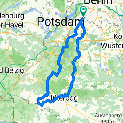 Berlin - Dobbrikow - Fläming - Jüterbog - Berlin
- Distance
- 156.8 km
- Ascent
- 378 m
- Descent
- 381 m
- Location
- Zehlendorf, Land Berlin, Germany
Open it in the app