rondje Achterveld Lunteren EderveenScherpenzeel 40,5km.
A cycling route starting in Terschuur, Provincie Gelderland, Netherlands.
Overview
About this route
rondje Achterveld Lunteren Ederveen Scherpenzeel 40,5km.
- -:--
- Duration
- 40.6 km
- Distance
- 59 m
- Ascent
- 57 m
- Descent
- ---
- Avg. speed
- ---
- Avg. speed
Route quality
Waytypes & surfaces along the route
Waytypes
Road
16.1 km
(40 %)
Quiet road
9.7 km
(24 %)
Surfaces
Paved
24.7 km
(61 %)
Unpaved
3.3 km
(8 %)
Asphalt
23 km
(56 %)
Sand
1.3 km
(3 %)
Continue with Bikemap
Use, edit, or download this cycling route
You would like to ride rondje Achterveld Lunteren EderveenScherpenzeel 40,5km. or customize it for your own trip? Here is what you can do with this Bikemap route:
Free features
- Save this route as favorite or in collections
- Copy & plan your own version of this route
- Sync your route with Garmin or Wahoo
Premium features
Free trial for 3 days, or one-time payment. More about Bikemap Premium.
- Navigate this route on iOS & Android
- Export a GPX / KML file of this route
- Create your custom printout (try it for free)
- Download this route for offline navigation
Discover more Premium features.
Get Bikemap PremiumFrom our community
Other popular routes starting in Terschuur
- testrouter
- Distance
- 6.3 km
- Ascent
- 4 m
- Descent
- 4 m
- Location
- Terschuur, Provincie Gelderland, Netherlands
- rondje Achterveld Amersfoort Woudenberg Leusden
- Distance
- 34 km
- Ascent
- 34 m
- Descent
- 36 m
- Location
- Terschuur, Provincie Gelderland, Netherlands
- rondje Achterveld Scherpenzeel Amerongen Leersum Woudenberg Scherpenzeel Achterveld
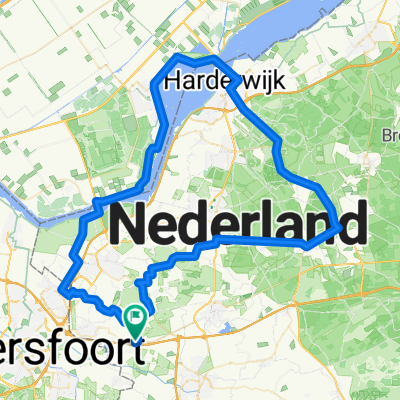
- Distance
- 45.6 km
- Ascent
- 104 m
- Descent
- 106 m
- Location
- Terschuur, Provincie Gelderland, Netherlands
- achterveld
- Distance
- 4.8 km
- Ascent
- 17 m
- Descent
- 18 m
- Location
- Terschuur, Provincie Gelderland, Netherlands
- zondag
- Distance
- 38.4 km
- Ascent
- 16 m
- Descent
- 16 m
- Location
- Terschuur, Provincie Gelderland, Netherlands
- rondje Achterveld Lunteren EderveenScherpenzeel 40,5km.
- Distance
- 40.6 km
- Ascent
- 59 m
- Descent
- 57 m
- Location
- Terschuur, Provincie Gelderland, Netherlands
- Rondje Apeldoorn
- Distance
- 158.1 km
- Ascent
- 278 m
- Descent
- 269 m
- Location
- Terschuur, Provincie Gelderland, Netherlands
- Kallenbroekerweg 182, Barneveld to Wildforster 67, Barneveld
- Distance
- 4.9 km
- Ascent
- 20 m
- Descent
- 17 m
- Location
- Terschuur, Provincie Gelderland, Netherlands
Open it in the app