Fietstocht rondje Lindelgrund 49 km
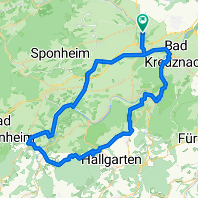
A cycling route starting in Hargesheim, Rhineland-Palatinate, Germany.
Overview
About this route
Fietstocht vanaf camping Lindelgrund in Guldental over het oude treinspoor Kleinbahn Radrundweg Ellerbachtal-Graefenbachtal. De rit er naar toe heeft redelijke steigingen en dalingen.
- -:--
- Duration
- 49 km
- Distance
- 500 m
- Ascent
- 494 m
- Descent
- ---
- Avg. speed
- ---
- Avg. speed
Route quality
Waytypes & surfaces along the route
Waytypes
Track
18.1 km
(37 %)
Quiet road
11.5 km
(23 %)
Surfaces
Paved
37.1 km
(76 %)
Unpaved
0 km
(<1 %)
Asphalt
28.1 km
(57 %)
Paved (undefined)
8 km
(16 %)
Continue with Bikemap
Use, edit, or download this cycling route
You would like to ride Fietstocht rondje Lindelgrund 49 km or customize it for your own trip? Here is what you can do with this Bikemap route:
Free features
- Save this route as favorite or in collections
- Copy & plan your own version of this route
- Sync your route with Garmin or Wahoo
Premium features
Free trial for 3 days, or one-time payment. More about Bikemap Premium.
- Navigate this route on iOS & Android
- Export a GPX / KML file of this route
- Create your custom printout (try it for free)
- Download this route for offline navigation
Discover more Premium features.
Get Bikemap PremiumFrom our community
Other popular routes starting in Hargesheim
- Fietstocht rondje Lindelgrund 49 km
- Distance
- 49 km
- Ascent
- 500 m
- Descent
- 494 m
- Location
- Hargesheim, Rhineland-Palatinate, Germany
- Guldental nach Bingen am Rhein
- Distance
- 15.4 km
- Ascent
- 196 m
- Descent
- 233 m
- Location
- Hargesheim, Rhineland-Palatinate, Germany
- ¿è?Ú? nach ¿è?Ú?
- Distance
- 11.4 km
- Ascent
- 168 m
- Descent
- 163 m
- Location
- Hargesheim, Rhineland-Palatinate, Germany
- KH - Bingen -Bacharach - Rheinböllen - Schanzer Kopf - Gräfenbachtal
- Distance
- 82.8 km
- Ascent
- 786 m
- Descent
- 806 m
- Location
- Hargesheim, Rhineland-Palatinate, Germany
- Entspannende Route in Hargesheim
- Distance
- 10.4 km
- Ascent
- 89 m
- Descent
- 100 m
- Location
- Hargesheim, Rhineland-Palatinate, Germany
- ¿è?Ú? nach ¿è?Ú?
- Distance
- 10.4 km
- Ascent
- 112 m
- Descent
- 110 m
- Location
- Hargesheim, Rhineland-Palatinate, Germany
- Tag 1
- Distance
- 41.1 km
- Ascent
- 212 m
- Descent
- 314 m
- Location
- Hargesheim, Rhineland-Palatinate, Germany
- Hängebrbi
- Distance
- 18.1 km
- Ascent
- 363 m
- Descent
- 212 m
- Location
- Hargesheim, Rhineland-Palatinate, Germany
Open it in the app