
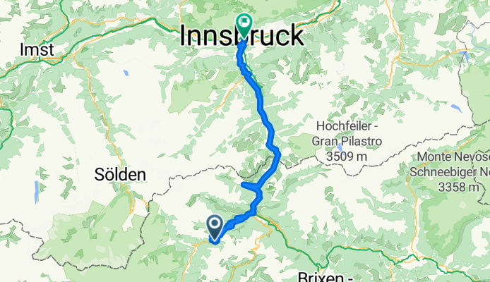
4.Etappe_MTB Füssen - Reschensee - Meran - Innsbruck
A cycling route starting in Ratschings, Trentino-Alto Adige, Italy.
Overview
About this route
Stage 4 from Innerwalten to Jaufenpass and then over the Brenner to Innsbruck - It was great!
- -:--
- Duration
- 93.1 km
- Distance
- 1,247 m
- Ascent
- 2,080 m
- Descent
- ---
- Avg. speed
- ---
- Max. altitude

Continue with Bikemap
Use, edit, or download this cycling route
You would like to ride 4.Etappe_MTB Füssen - Reschensee - Meran - Innsbruck or customize it for your own trip? Here is what you can do with this Bikemap route:
Free features
- Save this route as favorite or in collections
- Copy & plan your own version of this route
- Split it into stages to create a multi-day tour
- Sync your route with Garmin or Wahoo
Premium features
Free trial for 3 days, or one-time payment. More about Bikemap Premium.
- Navigate this route on iOS & Android
- Export a GPX / KML file of this route
- Create your custom printout (try it for free)
- Download this route for offline navigation
Discover more Premium features.
Get Bikemap PremiumFrom our community
Other popular routes starting in Ratschings
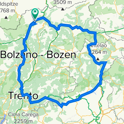 dolomiten runde grosss - variante molto bene
- Distance
- 450.8 km
- Ascent
- 7,529 m
- Descent
- 8,064 m
- Location
- Ratschings, Trentino-Alto Adige, Italy
 Südtirol-Spritztour Tag 2: Innerwalten - Holzkirchen
- Distance
- 194.2 km
- Ascent
- 1,714 m
- Descent
- 2,454 m
- Location
- Ratschings, Trentino-Alto Adige, Italy
 Interratschungs to Schonau Ötztaler Tour
- Distance
- 64 km
- Ascent
- 2,118 m
- Descent
- 1,769 m
- Location
- Ratschings, Trentino-Alto Adige, Italy
 Tappa 4: Flechnerhütte - Merano
- Distance
- 54.8 km
- Ascent
- 1,613 m
- Descent
- 3,359 m
- Location
- Ratschings, Trentino-Alto Adige, Italy
 jaufenpass off Sip 2019
- Distance
- 13.2 km
- Ascent
- 12 m
- Descent
- 1,424 m
- Location
- Ratschings, Trentino-Alto Adige, Italy
 Colle - Jaufenp - St. Leonardo - Vipiteno
- Distance
- 85.1 km
- Ascent
- 2,622 m
- Descent
- 2,911 m
- Location
- Ratschings, Trentino-Alto Adige, Italy
 Kerschbaumer Alm
- Distance
- 11.5 km
- Ascent
- 708 m
- Descent
- 654 m
- Location
- Ratschings, Trentino-Alto Adige, Italy
 4.Etappe_MTB Füssen - Reschensee - Meran - Innsbruck
- Distance
- 93.1 km
- Ascent
- 1,247 m
- Descent
- 2,080 m
- Location
- Ratschings, Trentino-Alto Adige, Italy
Open it in the app