

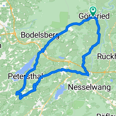
Görisried-Burgkranzegger Horn
A cycling route starting in Görisried, Bavaria, Germany.
Overview
About this route
Hügelige Voralpenstrecke mit schönen Aussichten
(cloned from route 3297044)
- -:--
- Duration
- 40.3 km
- Distance
- 594 m
- Ascent
- 596 m
- Descent
- ---
- Avg. speed
- ---
- Max. altitude
Route quality
Waytypes & surfaces along the route
Waytypes
Quiet road
22.2 km
(55 %)
Track
11.3 km
(28 %)
Surfaces
Paved
23.3 km
(58 %)
Unpaved
6.3 km
(16 %)
Asphalt
22.3 km
(55 %)
Gravel
4.2 km
(10 %)
Continue with Bikemap
Use, edit, or download this cycling route
You would like to ride Görisried-Burgkranzegger Horn or customize it for your own trip? Here is what you can do with this Bikemap route:
Free features
- Save this route as favorite or in collections
- Copy & plan your own version of this route
- Sync your route with Garmin or Wahoo
Premium features
Free trial for 3 days, or one-time payment. More about Bikemap Premium.
- Navigate this route on iOS & Android
- Export a GPX / KML file of this route
- Create your custom printout (try it for free)
- Download this route for offline navigation
Discover more Premium features.
Get Bikemap PremiumFrom our community
Other popular routes starting in Görisried
 Görisried-Burgkranzegger Horn
- Distance
- 40.3 km
- Ascent
- 594 m
- Descent
- 596 m
- Location
- Görisried, Bavaria, Germany
 Görisried – Unterjoch – Oberjoch – (Bildstöckl) – Königssträßle – Wertach – Elleg – Petersthal – Görisried
- Distance
- 92 km
- Ascent
- 1,519 m
- Descent
- 1,516 m
- Location
- Görisried, Bavaria, Germany
 Görisried-Memmingen-Görisried
- Distance
- 108.5 km
- Ascent
- 850 m
- Descent
- 876 m
- Location
- Görisried, Bavaria, Germany
 Goerisried
- Distance
- 44.8 km
- Ascent
- 656 m
- Descent
- 669 m
- Location
- Görisried, Bavaria, Germany
 dsdfsd
- Distance
- 9.5 km
- Ascent
- 105 m
- Descent
- 182 m
- Location
- Görisried, Bavaria, Germany
 Görisried–Wertach–Oberjoch–Tannheimer Tal–Reutte–Grän–Pfronten–Görisried
- Distance
- 119.8 km
- Ascent
- 856 m
- Descent
- 858 m
- Location
- Görisried, Bavaria, Germany
 Görisried – Grünten – Bildstöckle – Unterjoch – Görisried
- Distance
- 103.1 km
- Ascent
- 1,788 m
- Descent
- 1,789 m
- Location
- Görisried, Bavaria, Germany
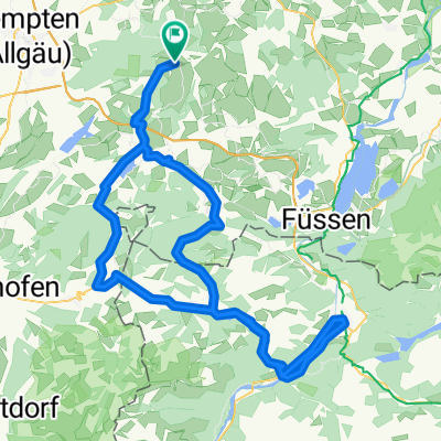
 Görisried - Nesselwang
- Distance
- 88.2 km
- Ascent
- 1,137 m
- Descent
- 1,094 m
- Location
- Görisried, Bavaria, Germany
Open it in the app