

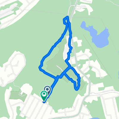
Dylan and Don Bike Ride
A cycling route starting in Stanhope, New Jersey, United States.
Overview
About this route
Dylan and Don's boy scout merit badge ride, 25 miles.
- -:--
- Duration
- 43.7 km
- Distance
- 312 m
- Ascent
- 312 m
- Descent
- ---
- Avg. speed
- ---
- Max. altitude
Route quality
Waytypes & surfaces along the route
Waytypes
Quiet road
28.3 km
(65 %)
Busy road
9.1 km
(21 %)
Surfaces
Paved
10.5 km
(24 %)
Asphalt
10.5 km
(24 %)
Undefined
33.2 km
(76 %)
Continue with Bikemap
Use, edit, or download this cycling route
You would like to ride Dylan and Don Bike Ride or customize it for your own trip? Here is what you can do with this Bikemap route:
Free features
- Save this route as favorite or in collections
- Copy & plan your own version of this route
- Sync your route with Garmin or Wahoo
Premium features
Free trial for 3 days, or one-time payment. More about Bikemap Premium.
- Navigate this route on iOS & Android
- Export a GPX / KML file of this route
- Create your custom printout (try it for free)
- Download this route for offline navigation
Discover more Premium features.
Get Bikemap PremiumFrom our community
Other popular routes starting in Stanhope
 allamuchy highlands trail
- Distance
- 72.5 km
- Ascent
- 459 m
- Descent
- 623 m
- Location
- Stanhope, New Jersey, United States
 Valley Road 17, Stanhope to Valley Road 17, Stanhope
- Distance
- 0 km
- Ascent
- 0 m
- Descent
- 0 m
- Location
- Stanhope, New Jersey, United States
 9 NJ-183, Stanhope to Landing
- Distance
- 4.8 km
- Ascent
- 50 m
- Descent
- 26 m
- Location
- Stanhope, New Jersey, United States
 Dylan and Don Bike Ride
- Distance
- 43.7 km
- Ascent
- 312 m
- Descent
- 312 m
- Location
- Stanhope, New Jersey, United States
 Lenape HS loop w/Jim
- Distance
- 4.7 km
- Ascent
- 194 m
- Descent
- 156 m
- Location
- Stanhope, New Jersey, United States
 Sunrise Mountain
- Distance
- 96.1 km
- Ascent
- 661 m
- Descent
- 661 m
- Location
- Stanhope, New Jersey, United States
 High Point Out and Back
- Distance
- 115.5 km
- Ascent
- 875 m
- Descent
- 892 m
- Location
- Stanhope, New Jersey, United States
 Andres Loop
- Distance
- 43.7 km
- Ascent
- 358 m
- Descent
- 361 m
- Location
- Stanhope, New Jersey, United States
Open it in the app