

Canencia-Altos del Hontanar 10.10.15
A cycling route starting in Canencia, Madrid, Spain.
Overview
About this route
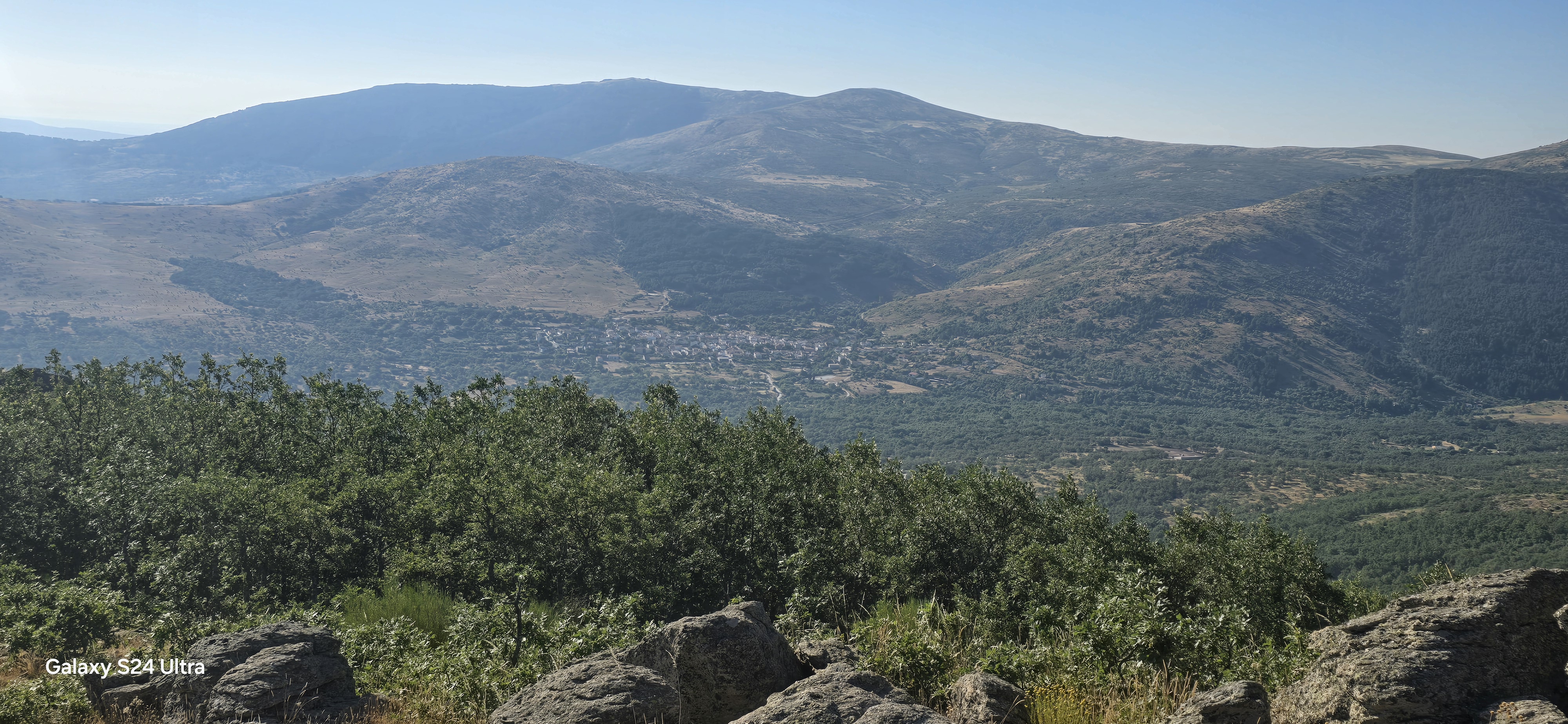
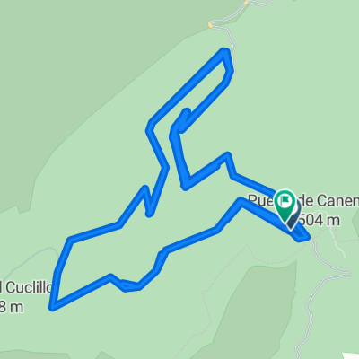
Route clockwise of 26 km in 2:51 and a total of 3:34 hours. We start from the parking lot at the Puerto de Canencia and begin on the trail that goes across the road towards the Puerto de la Morcuera. I mistakenly take a detour at km 1.9 to the left, but since I saw that they converged at the same point, the Puerto del Boquerón, I continued straight ahead, but the slope was a bit steeper. Then it's a traverse along the ridge called Los Altos del Hontanar, which separates the Lozoya valley from that of Canencia. We go down towards Canencia, but before arriving, after taking the descending road from the pass and crossing the Canencia stream, we turn right to take a trail that leads us to the meadow of Navasaces.
- -:--
- Duration
- 26 km
- Distance
- 700 m
- Ascent
- 700 m
- Descent
- ---
- Avg. speed
- ---
- Max. altitude

Continue with Bikemap
Use, edit, or download this cycling route
You would like to ride Canencia-Altos del Hontanar 10.10.15 or customize it for your own trip? Here is what you can do with this Bikemap route:
Free features
- Save this route as favorite or in collections
- Copy & plan your own version of this route
- Sync your route with Garmin or Wahoo
Premium features
Free trial for 3 days, or one-time payment. More about Bikemap Premium.
- Navigate this route on iOS & Android
- Export a GPX / KML file of this route
- Create your custom printout (try it for free)
- Download this route for offline navigation
Discover more Premium features.
Get Bikemap PremiumFrom our community
Other popular routes starting in Canencia
 Pinares de Canencia
- Distance
- 29.8 km
- Ascent
- 702 m
- Descent
- 717 m
- Location
- Canencia, Madrid, Spain
 Ruta a Ctra. Rascafria-Lozoya Km.
- Distance
- 17.5 km
- Ascent
- 122 m
- Descent
- 477 m
- Location
- Canencia, Madrid, Spain
 Pinares de Canencia
- Distance
- 10.5 km
- Ascent
- 314 m
- Descent
- 89 m
- Location
- Canencia, Madrid, Spain
 ruta calvete
- Distance
- 39.4 km
- Ascent
- 389 m
- Descent
- 385 m
- Location
- Canencia, Madrid, Spain
 De Calle Cantarranas a Calle Cantarranas
- Distance
- 31.3 km
- Ascent
- 1,177 m
- Descent
- 1,165 m
- Location
- Canencia, Madrid, Spain
 Canencia-Altos del Hontanar 10.10.15
- Distance
- 26 km
- Ascent
- 700 m
- Descent
- 700 m
- Location
- Canencia, Madrid, Spain
 Madrid: Canencia - Ctra Nava fria - San Mamés - Canencia
- Distance
- 56.6 km
- Ascent
- 1,180 m
- Descent
- 1,204 m
- Location
- Canencia, Madrid, Spain
 canencia (morcuera) regajo
- Distance
- 54.7 km
- Ascent
- 1,386 m
- Descent
- 1,386 m
- Location
- Canencia, Madrid, Spain
Open it in the app