

Ried im Traunkreis - Pettenbach (Ortszentren, Umgehung von Hauptverkehrsstraßen)
A cycling route starting in Sattledt, Upper Austria, Austria.
Overview
About this route
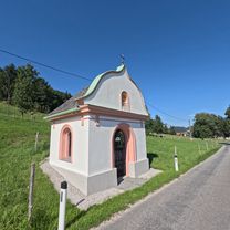
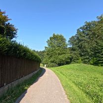
From the center of Ried, follow the main street southwest downhill out of town, cross the highway after about a kilometer, then continue along the road until you briefly reach federal road 138 in Voitsdorf. Turn left onto it, pass the junction with the country road to Pettenbach and Scharnstein (L562), then turn right onto the next street (Voitsdorf). At the fork immediately after, keep left, then follow the road southwest, crossing Voitsdorf and Schachadorf on the streets of the same name. After a sharper left curve downhill (see map) and the following ascent (keep right), you pass a larger farm, and at the next intersection turn left at a 90° angle. Follow this street for a few hundred meters until you pass a farm on the right and the road climbs again. Here, keep right onto an unpaved path (marked by bike route R13) that leads into the valley through the forest and is winding. In the forest, at an intersection, turn left uphill, then after a few meters reach a wider road and keep left onto Quellenweg. At the next fork, continue straight ahead, not being confused by the sign for R13 (POI). Now follow Wilflingstraße southwards until it bends right (southwest) in a somewhat larger settlement, then continue to follow it until you cross the railway tracks at the entrance to Pettenbach. Then ride along Welser Straße towards the center until you reach it and the church square. Duration: 25-30 minutes
- -:--
- Duration
- 10.9 km
- Distance
- 131 m
- Ascent
- 114 m
- Descent
- ---
- Avg. speed
- ---
- Max. altitude
Route quality
Waytypes & surfaces along the route
Waytypes
Quiet road
7.5 km
(69 %)
Road
0.5 km
(5 %)
Surfaces
Paved
4.9 km
(45 %)
Unpaved
0.5 km
(5 %)
Paved (undefined)
3.1 km
(28 %)
Asphalt
1.9 km
(17 %)
Continue with Bikemap
Use, edit, or download this cycling route
You would like to ride Ried im Traunkreis - Pettenbach (Ortszentren, Umgehung von Hauptverkehrsstraßen) or customize it for your own trip? Here is what you can do with this Bikemap route:
Free features
- Save this route as favorite or in collections
- Copy & plan your own version of this route
- Sync your route with Garmin or Wahoo
Premium features
Free trial for 3 days, or one-time payment. More about Bikemap Premium.
- Navigate this route on iOS & Android
- Export a GPX / KML file of this route
- Create your custom printout (try it for free)
- Download this route for offline navigation
Discover more Premium features.
Get Bikemap PremiumFrom our community
Other popular routes starting in Sattledt
 Rührndorf 53, Ried im Traunkreis nach Rührndorf 53, Ried im Traunkreis
- Distance
- 36.2 km
- Ascent
- 431 m
- Descent
- 431 m
- Location
- Sattledt, Upper Austria, Austria
 rus treining
- Distance
- 120.6 km
- Ascent
- 1,832 m
- Descent
- 1,830 m
- Location
- Sattledt, Upper Austria, Austria
 Voitsdorf-Steyrling
- Distance
- 48.1 km
- Ascent
- 778 m
- Descent
- 673 m
- Location
- Sattledt, Upper Austria, Austria
 Sattledt -Gmunden
- Distance
- 33.8 km
- Ascent
- 416 m
- Descent
- 395 m
- Location
- Sattledt, Upper Austria, Austria
 Maria am Wege Kapelle – Blick auf den Traunstein Runde von Sattledt
- Distance
- 69.8 km
- Ascent
- 545 m
- Descent
- 546 m
- Location
- Sattledt, Upper Austria, Austria
 Schloss Achleiten – die Krems Runde von Sattledt. 🚴♂️🚴
- Distance
- 56.1 km
- Ascent
- 569 m
- Descent
- 568 m
- Location
- Sattledt, Upper Austria, Austria
 Wk 3 - 1820 to 2780
- Distance
- 964 km
- Ascent
- 1,232 m
- Descent
- 1,534 m
- Location
- Sattledt, Upper Austria, Austria
 schwarzi Runde
- Distance
- 11.9 km
- Ascent
- 110 m
- Descent
- 113 m
- Location
- Sattledt, Upper Austria, Austria
Open it in the app