Mein Grüngürtel Rundweg
A cycling route starting in Mengenich, North Rhine-Westphalia, Germany.
Overview
About this route
The approximately 65-kilometer route around the Outer Green Belt of Cologne is distinctive. Perfectly suited for enthusiastic walkers and cyclists, as well as for Cologne residents who simply want to explore the Green Belt. After all, the Green Belt is a cultural asset of Cologne.
- -:--
- Duration
- 63.7 km
- Distance
- 95 m
- Ascent
- 103 m
- Descent
- ---
- Avg. speed
- ---
- Max. altitude
Route highlights
Points of interest along the route

Photo after 5.3 km
FORT 4 Befestigung der Stadt Köln Fort IV - Bocklemünd. Das Fort IV in Bocklemünd am Freimersdorfer Weg gelegen gehört zu den großen Forts in Köln.

Photo after 30.1 km
FORT 12 Das Fort XII in Köln-Stammheim wurde wie die anderen Werke des rechtsrheinischen Äußeren Gürtels im Zeitraum 1877-1881 erbaut.

Photo after 33.9 km
Zwischenwerk XI B Das Zwischenwerk XI b an der Berliner Straße wurde in den Jahren 1877 bis 1881 als Teil des äußeren Preußischen Festungsgürtels rund um Köln errichtet.

Photo after 35 km
FORT XI Das zwischen 1877 und 1881 errichtete Fort XI liegt an der Piccoloministraße und Mülheimer Ring. Es gehört zu dem in dieser Zeit errichteten rechtsrheinischen Teil des Kölner Festungsringes.

Photo after 39.9 km
FORT X (Höhenberg) Frankfurter Str./Ecke Nohlenweg m Köln Die rechtsrheinischen Forts wurden im Zeitraum 1877 bis 1881 erbaut. Es gehört zu den 4 dort erstellten Forts.

Photo after 42 km
Zwischenwerk Xa Östlich vom Vingster Ring, nördlich des Hardtgenbuschweges lag das zwischen 1877-1879 erbaute Zwischenwerk Xa (Baugleich mit dem Zwischenwerk IXb).

Photo after 47.6 km
Zwischenwerk IXa Das Zwischenwerk IXa liegt auf dem ehemaligen Gelände einer Wehrmachtskaserne. Diese wurde nach dem Weltkrieg von der Belgischen Armee weitergenutzt. Inzwischen wurden die Liegenschaften vom Militär aufgegeben.

Photo after 50.6 km
Kölner Festungsmuseum Die preußische Festung Cöln mit dem Inneren (1815) und Äußeren (1873) Festungsgürtel wird mit Plänen, Schautafeln und Exponaten umfangreich dokumentiert.

Photo after 57.7 km
Zwischenwerk VII Das Zwischenwerk VII lag südlich des Kreuzungspunktes Luxemburger Straße und Militärring.

Photo after 58.8 km
Zwischenwerk VIb Das Zwischenwerk VIb liegt in der Nähe der Berrenrather Str. dort wo der Geißbockheim 1Fc Köln.

Photo after 60.1 km
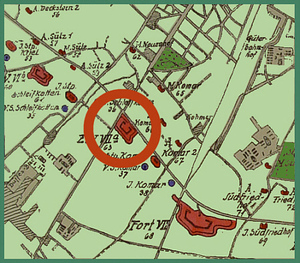
FORT IV Das in Deckstein gelegene Fort VI wurde 1873 als erstes der zwölf großen Forts in Köln erbaut.

Photo after 63.4 km
START und ZIEL.: (Rheinenergie-Stadion) vor der Haupteingang Köln Müngersdorf Erreichbar mit die KVB Linie 1
Continue with Bikemap
Use, edit, or download this cycling route
You would like to ride Mein Grüngürtel Rundweg or customize it for your own trip? Here is what you can do with this Bikemap route:
Free features
- Save this route as favorite or in collections
- Copy & plan your own version of this route
- Sync your route with Garmin or Wahoo
Premium features
Free trial for 3 days, or one-time payment. More about Bikemap Premium.
- Navigate this route on iOS & Android
- Export a GPX / KML file of this route
- Create your custom printout (try it for free)
- Download this route for offline navigation
Discover more Premium features.
Get Bikemap PremiumFrom our community
Other popular routes starting in Mengenich
 Köln - Aachen
- Distance
- 72 km
- Ascent
- 475 m
- Descent
- 365 m
- Location
- Mengenich, North Rhine-Westphalia, Germany
 Bedburg Alt-Kaster
- Distance
- 60.1 km
- Ascent
- 131 m
- Descent
- 130 m
- Location
- Mengenich, North Rhine-Westphalia, Germany
 Mein Grüngürtel Rundweg
- Distance
- 63.7 km
- Ascent
- 95 m
- Descent
- 103 m
- Location
- Mengenich, North Rhine-Westphalia, Germany
 LF - Auweiler rum
- Distance
- 12.9 km
- Ascent
- 39 m
- Descent
- 39 m
- Location
- Mengenich, North Rhine-Westphalia, Germany
 Coloneumrunde
- Distance
- 33 km
- Ascent
- 77 m
- Descent
- 75 m
- Location
- Mengenich, North Rhine-Westphalia, Germany
 Runde Fühlinger See Worringen
- Distance
- 40 km
- Ascent
- 158 m
- Descent
- 204 m
- Location
- Mengenich, North Rhine-Westphalia, Germany
 Ausflug
- Distance
- 53 km
- Ascent
- 166 m
- Descent
- 166 m
- Location
- Mengenich, North Rhine-Westphalia, Germany
 Köln-WahnerHeide-Rheintour
- Distance
- 71.5 km
- Ascent
- 160 m
- Descent
- 160 m
- Location
- Mengenich, North Rhine-Westphalia, Germany
Open it in the app


