

Eastern HSDRRS Levee Ride
A cycling route starting in Arabi, Louisiana, United States.
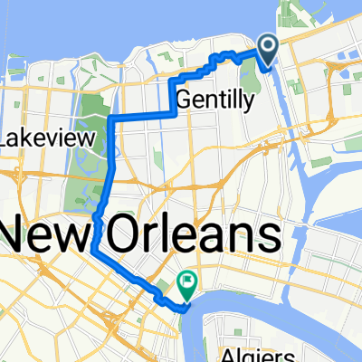
Overview
About this route
30 mile ride around Bayou Sauvage atop the levee system.
- -:--
- Duration
- 48.3 km
- Distance
- 23 m
- Ascent
- 20 m
- Descent
- ---
- Avg. speed
- ---
- Max. altitude
Route highlights
Points of interest along the route

Photo after 16.2 km
Pump Station No. 15 consists of a 653-foot long T-wall located at Pump Station No. 15. The T-wall was repaired after being damaged by Hurricane Katrina and raised to +22 feet NAVD 88. Three 72-inch discharge pipes from Pump Station No. 15 pass through the T-wall and outlet into a discharge basin on the T-wall’s flood (GIWW) side. The Collins petroleum pipeline also extends through the T-wall stem. The T-wall section has since been raised to +34 feet NAVD 88.
Continue with Bikemap
Use, edit, or download this cycling route
You would like to ride Eastern HSDRRS Levee Ride or customize it for your own trip? Here is what you can do with this Bikemap route:
Free features
- Save this route as favorite or in collections
- Copy & plan your own version of this route
- Sync your route with Garmin or Wahoo
Premium features
Free trial for 3 days, or one-time payment. More about Bikemap Premium.
- Navigate this route on iOS & Android
- Export a GPX / KML file of this route
- Create your custom printout (try it for free)
- Download this route for offline navigation
Discover more Premium features.
Get Bikemap PremiumFrom our community
Other popular routes starting in Arabi
 Eastern HSDRRS Levee Ride
- Distance
- 48.3 km
- Ascent
- 23 m
- Descent
- 20 m
- Location
- Arabi, Louisiana, United States
 New Orleans Jazz National Park Service bike tour
- Distance
- 14.5 km
- Ascent
- 17 m
- Descent
- 19 m
- Location
- Arabi, Louisiana, United States
 East Route to Dowmman
- Distance
- 21.4 km
- Ascent
- 43 m
- Descent
- 44 m
- Location
- Arabi, Louisiana, United States
 Algiers Social Ride
- Distance
- 3.7 km
- Ascent
- 10 m
- Descent
- 8 m
- Location
- Arabi, Louisiana, United States
 Pontchartrain Park, New Orleans to Decatur St, New Orleans
- Distance
- 16.8 km
- Ascent
- 40 m
- Descent
- 39 m
- Location
- Arabi, Louisiana, United States
 Eastern HSDRRS
- Distance
- 48.6 km
- Ascent
- 31 m
- Descent
- 30 m
- Location
- Arabi, Louisiana, United States
 2202 Desire St, New Orleans to 1361–1399 N Rocheblave St, New Orleans
- Distance
- 5.6 km
- Ascent
- 9 m
- Descent
- 0 m
- Location
- Arabi, Louisiana, United States
 Chartres Street 4000, New Orleans to Port of New Orleans Place 1100
- Distance
- 5.5 km
- Ascent
- 31 m
- Descent
- 24 m
- Location
- Arabi, Louisiana, United States
Open it in the app