

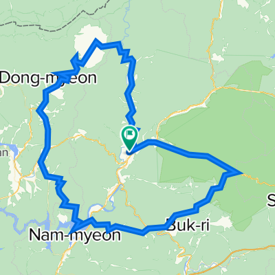
원통-한계령-필례한계령-남전리-인제38대교-두무리-용하리-돌산령-원통
A cycling route starting in Dongmyeon, Gangwon-do, Republic of Korea.
Overview
About this route
원통-한계령-필례한계령-남전리-인제38대교-두무리-용하리-돌산령-원통
- -:--
- Duration
- 143.3 km
- Distance
- 1,806 m
- Ascent
- 1,810 m
- Descent
- ---
- Avg. speed
- ---
- Avg. speed
Continue with Bikemap
Use, edit, or download this cycling route
You would like to ride 원통-한계령-필례한계령-남전리-인제38대교-두무리-용하리-돌산령-원통 or customize it for your own trip? Here is what you can do with this Bikemap route:
Free features
- Save this route as favorite or in collections
- Copy & plan your own version of this route
- Split it into stages to create a multi-day tour
- Sync your route with Garmin or Wahoo
Premium features
Free trial for 3 days, or one-time payment. More about Bikemap Premium.
- Navigate this route on iOS & Android
- Export a GPX / KML file of this route
- Create your custom printout (try it for free)
- Download this route for offline navigation
Discover more Premium features.
Get Bikemap PremiumFrom our community
Other popular routes starting in Dongmyeon
 원통-한계령-필례한계령-남전리-두무리-용하리-돌산령-원통
- Distance
- 143.5 km
- Ascent
- 1,800 m
- Descent
- 1,804 m
- Location
- Dongmyeon, Gangwon-do, Republic of Korea
 원통-한계령-속초-미시령-원통 112km
- Distance
- 112.2 km
- Ascent
- 1,613 m
- Descent
- 1,616 m
- Location
- Dongmyeon, Gangwon-do, Republic of Korea
 원통-한계령-양양-속초 69km 930m
- Distance
- 68.7 km
- Ascent
- 1,137 m
- Descent
- 1,362 m
- Location
- Dongmyeon, Gangwon-do, Republic of Korea
 원통-한계령-필례한계령-남전리-인제38대교-두무리-용하리-돌산령-원통
- Distance
- 143.3 km
- Ascent
- 1,806 m
- Descent
- 1,810 m
- Location
- Dongmyeon, Gangwon-do, Republic of Korea
 원통-한계령-미시령-원통 112km
- Distance
- 112.4 km
- Ascent
- 1,602 m
- Descent
- 1,605 m
- Location
- Dongmyeon, Gangwon-do, Republic of Korea
 속초-21한계령-74바두재-82전후치-120강릉
- Distance
- 120.1 km
- Ascent
- 1,440 m
- Descent
- 1,644 m
- Location
- Dongmyeon, Gangwon-do, Republic of Korea
 원통-미시령-싸리재-떡발재-속초
- Distance
- 55.8 km
- Ascent
- 691 m
- Descent
- 916 m
- Location
- Dongmyeon, Gangwon-do, Republic of Korea
 한계령사이클
- Distance
- 56.6 km
- Ascent
- 1,997 m
- Descent
- 1,997 m
- Location
- Dongmyeon, Gangwon-do, Republic of Korea
Open it in the app