

etappe 11?
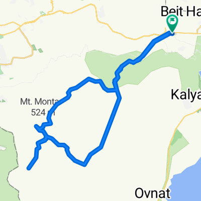
A cycling route starting in Jericho, West Bank, Palestine.
Overview
About this route
- -:--
- Duration
- 290.7 km
- Distance
- 1,396 m
- Ascent
- 1,062 m
- Descent
- ---
- Avg. speed
- ---
- Max. altitude
Continue with Bikemap
Use, edit, or download this cycling route
You would like to ride etappe 11? or customize it for your own trip? Here is what you can do with this Bikemap route:
Free features
- Save this route as favorite or in collections
- Copy & plan your own version of this route
- Split it into stages to create a multi-day tour
- Sync your route with Garmin or Wahoo
Premium features
Free trial for 3 days, or one-time payment. More about Bikemap Premium.
- Navigate this route on iOS & Android
- Export a GPX / KML file of this route
- Create your custom printout (try it for free)
- Download this route for offline navigation
Discover more Premium features.
Get Bikemap PremiumFrom our community
Other popular routes starting in Jericho
 Almog Junction nach Almog Junction
- Distance
- 19.5 km
- Ascent
- 298 m
- Descent
- 298 m
- Location
- Jericho, West Bank, Palestine
 Israel
- Distance
- 1,466 km
- Ascent
- 6,286 m
- Descent
- 6,286 m
- Location
- Jericho, West Bank, Palestine
 Azja Jericho-Jerusalem
- Distance
- 42.6 km
- Ascent
- 1,255 m
- Descent
- 251 m
- Location
- Jericho, West Bank, Palestine
 Marsaba plus
- Distance
- 44.6 km
- Ascent
- 933 m
- Descent
- 933 m
- Location
- Jericho, West Bank, Palestine
 לידו - מצוקי דרגות - עין גדי וחזרה
- Distance
- 90.8 km
- Ascent
- 6 m
- Descent
- 6 m
- Location
- Jericho, West Bank, Palestine
 Israel Totes Meer
- Distance
- 56.5 km
- Ascent
- 407 m
- Descent
- 403 m
- Location
- Jericho, West Bank, Palestine
 Totes Meer - Eilat
- Distance
- 274.1 km
- Ascent
- 995 m
- Descent
- 585 m
- Location
- Jericho, West Bank, Palestine
 예리코 예루살렘
- Distance
- 57.8 km
- Ascent
- 1,012 m
- Descent
- 248 m
- Location
- Jericho, West Bank, Palestine
Open it in the app