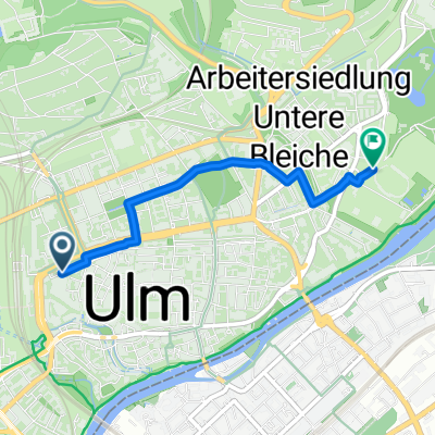
Albert-Einstein-Platz, Ulm nach Stadionstraße, Ulm
- 2.7 km
- 10 m
- 20 m
- Ulm, Baden-Wurttemberg, Germany
A cycling route starting in Ulm, Baden-Wurttemberg, Germany.
Overview
Starting in downtown Ulm, the route first heads towards the Danube. You ride upstream to the beginning of the Donautal industrial area, then north up the Lindenhöhe and on to Fort Oberer Kuhberg. Once up there, you head west along field paths towards Allewind. Then you zigzag through fields and forests to Arnegg. From there, the return journey heads east. In Blaustein, you follow a nice bike path along the Blau. Then you continue on a long bike path parallel to the rail tracks back to Ulm.
created this 16 years ago
Route highlights

Continue with Bikemap
You would like to ride Rundkurs westlich von Ulm or customize it for your own trip? Here is what you can do with this Bikemap route:
Free trial for 3 days, or one-time payment. More about Bikemap Premium.
Discover more Premium features.
Get Bikemap PremiumFrom our community
Open it in the app