

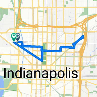
work to irvington
A cycling route starting in Indianapolis, Indiana, United States.
Overview
About this route
from 1635 w mich st to the outside of irvington.
(cloned from route 3305980)
- -:--
- Duration
- 22.2 km
- Distance
- 83 m
- Ascent
- 33 m
- Descent
- ---
- Avg. speed
- ---
- Max. altitude

Route quality
Waytypes & surfaces along the route
Waytypes
Cycleway
15.6 km
(70 %)
Quiet road
2 km
(9 %)
Surfaces
Paved
10 km
(45 %)
Asphalt
7.6 km
(34 %)
Paved (undefined)
1.8 km
(8 %)
Continue with Bikemap
Use, edit, or download this cycling route
You would like to ride work to irvington or customize it for your own trip? Here is what you can do with this Bikemap route:
Free features
- Save this route as favorite or in collections
- Copy & plan your own version of this route
- Sync your route with Garmin or Wahoo
Premium features
Free trial for 3 days, or one-time payment. More about Bikemap Premium.
- Navigate this route on iOS & Android
- Export a GPX / KML file of this route
- Create your custom printout (try it for free)
- Download this route for offline navigation
Discover more Premium features.
Get Bikemap PremiumFrom our community
Other popular routes starting in Indianapolis
 city loop March Madness 2019
- Distance
- 42.7 km
- Ascent
- 63 m
- Descent
- 62 m
- Location
- Indianapolis, Indiana, United States
 Cultural Trail and Central Canal Loop
- Distance
- 11.5 km
- Ascent
- 27 m
- Descent
- 24 m
- Location
- Indianapolis, Indiana, United States
 1125 Brookside Ave, Indianapolis to 1166–1198 E Tenth St, Indianapolis
- Distance
- 89.1 km
- Ascent
- 740 m
- Descent
- 744 m
- Location
- Indianapolis, Indiana, United States
 4.01. 7.14.2025
- Distance
- 6.5 km
- Ascent
- 75 m
- Descent
- 26 m
- Location
- Indianapolis, Indiana, United States
 Up and Back
- Distance
- 58.3 km
- Ascent
- 79 m
- Descent
- 76 m
- Location
- Indianapolis, Indiana, United States
 Possible Friday Evening Route
- Distance
- 11.9 km
- Ascent
- 49 m
- Descent
- 46 m
- Location
- Indianapolis, Indiana, United States
 Home to the Dugout
- Distance
- 2.4 km
- Ascent
- 4 m
- Descent
- 8 m
- Location
- Indianapolis, Indiana, United States
 Possible Friday Evening Route
- Distance
- 12.5 km
- Ascent
- 64 m
- Descent
- 62 m
- Location
- Indianapolis, Indiana, United States
Open it in the app