

Innerste-Hahnenklee; 42km, 920hm
A cycling route starting in Langelsheim, Lower Saxony, Germany.
Overview
About this route
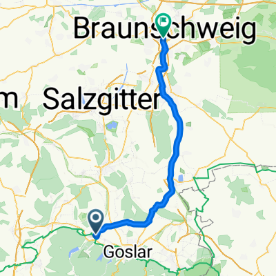
Tour route:
Innerstetalsperre Wolfshagen Granetalsperre Hahnenklee Granetalsperre Innerstetalsperre- -:--
- Duration
- 42.2 km
- Distance
- 795 m
- Ascent
- 797 m
- Descent
- ---
- Avg. speed
- ---
- Max. altitude

Route quality
Waytypes & surfaces along the route
Waytypes
Track
35.1 km
(83 %)
Quiet road
2.1 km
(5 %)
Surfaces
Paved
15.2 km
(36 %)
Unpaved
26.2 km
(62 %)
Gravel
19.4 km
(46 %)
Asphalt
15.2 km
(36 %)
Continue with Bikemap
Use, edit, or download this cycling route
You would like to ride Innerste-Hahnenklee; 42km, 920hm or customize it for your own trip? Here is what you can do with this Bikemap route:
Free features
- Save this route as favorite or in collections
- Copy & plan your own version of this route
- Sync your route with Garmin or Wahoo
Premium features
Free trial for 3 days, or one-time payment. More about Bikemap Premium.
- Navigate this route on iOS & Android
- Export a GPX / KML file of this route
- Create your custom printout (try it for free)
- Download this route for offline navigation
Discover more Premium features.
Get Bikemap PremiumFrom our community
Other popular routes starting in Langelsheim
 Innerste-Hahnenklee; 42km, 920hm
- Distance
- 42.2 km
- Ascent
- 795 m
- Descent
- 797 m
- Location
- Langelsheim, Lower Saxony, Germany
 3.Etappe
- Distance
- 170.8 km
- Ascent
- 931 m
- Descent
- 1,050 m
- Location
- Langelsheim, Lower Saxony, Germany
 Innerstetal- und Granetalsperre
- Distance
- 39.8 km
- Ascent
- 346 m
- Descent
- 341 m
- Location
- Langelsheim, Lower Saxony, Germany
 Rundfahrt Innerste
- Distance
- 23.7 km
- Ascent
- 544 m
- Descent
- 544 m
- Location
- Langelsheim, Lower Saxony, Germany
 Jerstedt - Granetalsperre - Grauhöfer Holz
- Distance
- 35.8 km
- Ascent
- 394 m
- Descent
- 375 m
- Location
- Langelsheim, Lower Saxony, Germany
 Braunschweig
- Distance
- 51.2 km
- Ascent
- 127 m
- Descent
- 252 m
- Location
- Langelsheim, Lower Saxony, Germany
 Eröffnungstour HARZ 2013
- Distance
- 39.1 km
- Ascent
- 968 m
- Descent
- 968 m
- Location
- Langelsheim, Lower Saxony, Germany
 Tour de Wade - Harz KA Training
- Distance
- 80.6 km
- Ascent
- 1,095 m
- Descent
- 1,002 m
- Location
- Langelsheim, Lower Saxony, Germany
Open it in the app