

SKT-Tour 15 10 22
A cycling route starting in Eisighofen, Rhineland-Palatinate, Germany.
Overview
About this route
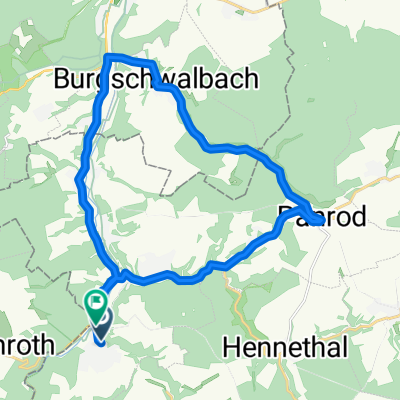
Überwiegend ebene Strecke von Kettenbach nach Limburg und Diez mit zwei Steigungen.
- -:--
- Duration
- 49.5 km
- Distance
- 204 m
- Ascent
- 204 m
- Descent
- ---
- Avg. speed
- ---
- Max. altitude
Continue with Bikemap
Use, edit, or download this cycling route
You would like to ride SKT-Tour 15 10 22 or customize it for your own trip? Here is what you can do with this Bikemap route:
Free features
- Save this route as favorite or in collections
- Copy & plan your own version of this route
- Sync your route with Garmin or Wahoo
Premium features
Free trial for 3 days, or one-time payment. More about Bikemap Premium.
- Navigate this route on iOS & Android
- Export a GPX / KML file of this route
- Create your custom printout (try it for free)
- Download this route for offline navigation
Discover more Premium features.
Get Bikemap PremiumFrom our community
Other popular routes starting in Eisighofen
 Aar-Lahn
- Distance
- 66.6 km
- Ascent
- 328 m
- Descent
- 331 m
- Location
- Eisighofen, Rhineland-Palatinate, Germany
 Eisenstraße_RRP
- Distance
- 13.4 km
- Ascent
- 339 m
- Descent
- 167 m
- Location
- Eisighofen, Rhineland-Palatinate, Germany
 Rund um Eisighofen
- Distance
- 30.5 km
- Ascent
- 547 m
- Descent
- 547 m
- Location
- Eisighofen, Rhineland-Palatinate, Germany
 SKT-Tour 15 10 22
- Distance
- 49.5 km
- Ascent
- 204 m
- Descent
- 204 m
- Location
- Eisighofen, Rhineland-Palatinate, Germany
 Aar - Burgschwalbach
- Distance
- 22.1 km
- Ascent
- 223 m
- Descent
- 234 m
- Location
- Eisighofen, Rhineland-Palatinate, Germany
 Aarbergen - Feldberg - Aarbergen
- Distance
- 98.5 km
- Ascent
- 1,293 m
- Descent
- 1,295 m
- Location
- Eisighofen, Rhineland-Palatinate, Germany
 Aus Michelbach - rund um Holzhausen.
- Distance
- 13.9 km
- Ascent
- 286 m
- Descent
- 232 m
- Location
- Eisighofen, Rhineland-Palatinate, Germany
 Michelbach - Taunusstein
- Distance
- 41.1 km
- Ascent
- 509 m
- Descent
- 509 m
- Location
- Eisighofen, Rhineland-Palatinate, Germany
Open it in the app