

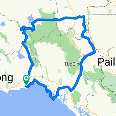
Rayong - Chantaburi
A cycling route starting in Klaeng, Changwat Rayong, Thailand.
Overview
About this route
-
Etappe Rayong - Chantaburi
(cloned from route 3310248)
- -:--
- Duration
- 91.5 km
- Distance
- 178 m
- Ascent
- 179 m
- Descent
- ---
- Avg. speed
- ---
- Avg. speed
Route quality
Waytypes & surfaces along the route
Waytypes
Busy road
31.9 km
(35 %)
Quiet road
31.1 km
(34 %)
Surfaces
Paved
22.3 km
(24 %)
Unpaved
4.9 km
(5 %)
Asphalt
15.4 km
(17 %)
Paved (undefined)
6.9 km
(8 %)
Continue with Bikemap
Use, edit, or download this cycling route
You would like to ride Rayong - Chantaburi or customize it for your own trip? Here is what you can do with this Bikemap route:
Free features
- Save this route as favorite or in collections
- Copy & plan your own version of this route
- Sync your route with Garmin or Wahoo
Premium features
Free trial for 3 days, or one-time payment. More about Bikemap Premium.
- Navigate this route on iOS & Android
- Export a GPX / KML file of this route
- Create your custom printout (try it for free)
- Download this route for offline navigation
Discover more Premium features.
Get Bikemap PremiumFrom our community
Other popular routes starting in Klaeng
 Rayong Prolog
- Distance
- 77.8 km
- Ascent
- 282 m
- Descent
- 285 m
- Location
- Klaeng, Changwat Rayong, Thailand
 2) Laem Maephim - Ban Chang
- Distance
- 76.5 km
- Ascent
- 140 m
- Descent
- 114 m
- Location
- Klaeng, Changwat Rayong, Thailand
 lammae pit / Centrepoint
- Distance
- 155.8 km
- Ascent
- 620 m
- Descent
- 621 m
- Location
- Klaeng, Changwat Rayong, Thailand
 Rayong - Chantaburi
- Distance
- 91.5 km
- Ascent
- 178 m
- Descent
- 179 m
- Location
- Klaeng, Changwat Rayong, Thailand
 Klaeng - rayong
- Distance
- 56.1 km
- Ascent
- 279 m
- Descent
- 275 m
- Location
- Klaeng, Changwat Rayong, Thailand
 Recording from February 21, 08:22
- Distance
- 44.9 km
- Ascent
- 46 m
- Descent
- 44 m
- Location
- Klaeng, Changwat Rayong, Thailand
 Jour 70 – Klaeng - Rayong
- Distance
- 63.2 km
- Ascent
- 100 m
- Descent
- 103 m
- Location
- Klaeng, Changwat Rayong, Thailand
 AUDAX 400 -2020
- Distance
- 402.9 km
- Ascent
- 1,859 m
- Descent
- 1,859 m
- Location
- Klaeng, Changwat Rayong, Thailand
Open it in the app