
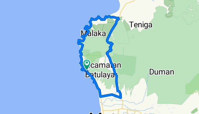
15 + 1 peaks plus a monkey forest
A cycling route starting in Mambalan, West Nusa Tenggara, Indonesia.
Overview
About this route
Beautiful ride along deserted beaches, coconut groves, fishermen villages and a long ride up the monkey forest trying not to annoy the dozens of monkeys.
Senggigi > 12 beaches/peaks > Pemenang > Pusuk Pass (incl. monkey forest) > Gunungsari > Meninting > 3 beaches/peaks > Senggigi Don't underestimate the sum of elevation changes (especially on a misfitting rented bike ;-) Could be that Bikemap.net doesn't sum up the elevation properly. I summed up rather 760 than 590 meters of elevation. (cloned from route 1155087)- -:--
- Duration
- 54 km
- Distance
- 518 m
- Ascent
- 518 m
- Descent
- ---
- Avg. speed
- ---
- Max. altitude
Continue with Bikemap
Use, edit, or download this cycling route
You would like to ride 15 + 1 peaks plus a monkey forest or customize it for your own trip? Here is what you can do with this Bikemap route:
Free features
- Save this route as favorite or in collections
- Copy & plan your own version of this route
- Sync your route with Garmin or Wahoo
Premium features
Free trial for 3 days, or one-time payment. More about Bikemap Premium.
- Navigate this route on iOS & Android
- Export a GPX / KML file of this route
- Create your custom printout (try it for free)
- Download this route for offline navigation
Discover more Premium features.
Get Bikemap PremiumFrom our community
Other popular routes starting in Mambalan
 15 + 1 peaks plus a monkey forest
- Distance
- 54 km
- Ascent
- 518 m
- Descent
- 518 m
- Location
- Mambalan, West Nusa Tenggara, Indonesia
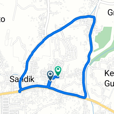
 Jalan Pariwisata 14x, Batu Layar to Jalan Kembung 8, Kecamatan Ampenan
- Distance
- 6.5 km
- Ascent
- 82 m
- Descent
- 75 m
- Location
- Mambalan, West Nusa Tenggara, Indonesia
 Jalan Pariwisata 32, Gunung Sari to Jalan Pariwisata 32, Gunung Sari
- Distance
- 15.3 km
- Ascent
- 36 m
- Descent
- 47 m
- Location
- Mambalan, West Nusa Tenggara, Indonesia
 15 + 1 peaks plus a monkey forest
- Distance
- 54 km
- Ascent
- 528 m
- Descent
- 528 m
- Location
- Mambalan, West Nusa Tenggara, Indonesia
 Lombok- Matarm to Gunungsari-Bukit Kedondong-Senggigi
- Distance
- 13.1 km
- Ascent
- 476 m
- Descent
- 497 m
- Location
- Mambalan, West Nusa Tenggara, Indonesia
 Jalan Pariwisata 40, Gunung Sari to Jalan Pariwisata 32, Gunung Sari
- Distance
- 9.9 km
- Ascent
- 87 m
- Descent
- 91 m
- Location
- Mambalan, West Nusa Tenggara, Indonesia
 meninting batu layar
- Distance
- 7.1 km
- Ascent
- 70 m
- Descent
- 75 m
- Location
- Mambalan, West Nusa Tenggara, Indonesia
 L-6 to L-6
- Distance
- 3.6 km
- Ascent
- 18 m
- Descent
- 58 m
- Location
- Mambalan, West Nusa Tenggara, Indonesia
Open it in the app