

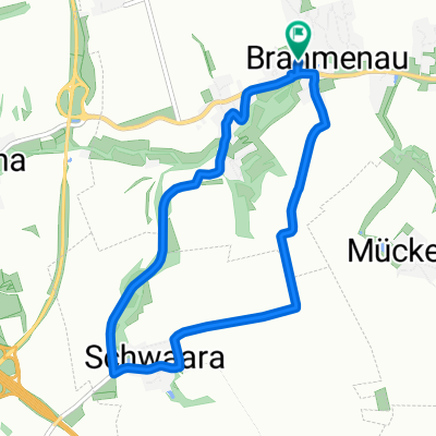
Brahmenau
A cycling route starting in Brahmenau, Thuringia, Germany.
Overview
About this route
24.08.14 13:07 (cloned from route 2770204)
(cloned from route 2968553)
- -:--
- Duration
- 22.2 km
- Distance
- 151 m
- Ascent
- 150 m
- Descent
- ---
- Avg. speed
- ---
- Max. altitude
Route quality
Waytypes & surfaces along the route
Waytypes
Quiet road
9.3 km
(42 %)
Road
5.5 km
(25 %)
Surfaces
Paved
11.5 km
(52 %)
Asphalt
6.2 km
(28 %)
Paved (undefined)
3.8 km
(17 %)
Continue with Bikemap
Use, edit, or download this cycling route
You would like to ride Brahmenau or customize it for your own trip? Here is what you can do with this Bikemap route:
Free features
- Save this route as favorite or in collections
- Copy & plan your own version of this route
- Sync your route with Garmin or Wahoo
Premium features
Free trial for 3 days, or one-time payment. More about Bikemap Premium.
- Navigate this route on iOS & Android
- Export a GPX / KML file of this route
- Create your custom printout (try it for free)
- Download this route for offline navigation
Discover more Premium features.
Get Bikemap PremiumFrom our community
Other popular routes starting in Brahmenau
 Brahmenau
- Distance
- 22.1 km
- Ascent
- 149 m
- Descent
- 148 m
- Location
- Brahmenau, Thuringia, Germany
 Birkenhof 3, Brahmenau nach Talsperrenstraße 15, Langenbernsdorf
- Distance
- 26.7 km
- Ascent
- 324 m
- Descent
- 317 m
- Location
- Brahmenau, Thuringia, Germany
 Söllmnitz 62, Gera nach K5 5, Gera
- Distance
- 0.1 km
- Ascent
- 0 m
- Descent
- 39 m
- Location
- Brahmenau, Thuringia, Germany
 Brahmenau
- Distance
- 22.2 km
- Ascent
- 151 m
- Descent
- 150 m
- Location
- Brahmenau, Thuringia, Germany
 Nauendorf-Trainingsstrecke
- Distance
- 9 km
- Ascent
- 18 m
- Descent
- 15 m
- Location
- Brahmenau, Thuringia, Germany
 zillertal
- Distance
- 109 km
- Ascent
- 959 m
- Descent
- 958 m
- Location
- Brahmenau, Thuringia, Germany
 Rundkurs am Brahmrtal
- Distance
- 13.8 km
- Ascent
- 98 m
- Descent
- 95 m
- Location
- Brahmenau, Thuringia, Germany
 Brunnenweg, Brahmenau nach Brunnenweg, Brahmenau
- Distance
- 6.9 km
- Ascent
- 47 m
- Descent
- 49 m
- Location
- Brahmenau, Thuringia, Germany
Open it in the app