

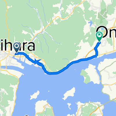
10-29-2013_Day56
A cycling route starting in Mihara, Hiroshima, Japan.
Overview
About this route
10-29-2013_Day56
しまなみ海道 瀨戶內島波海道- -:--
- Duration
- 183.8 km
- Distance
- 764 m
- Ascent
- 742 m
- Descent
- ---
- Avg. speed
- ---
- Max. altitude

Continue with Bikemap
Use, edit, or download this cycling route
You would like to ride 10-29-2013_Day56 or customize it for your own trip? Here is what you can do with this Bikemap route:
Free features
- Save this route as favorite or in collections
- Copy & plan your own version of this route
- Split it into stages to create a multi-day tour
- Sync your route with Garmin or Wahoo
Premium features
Free trial for 3 days, or one-time payment. More about Bikemap Premium.
- Navigate this route on iOS & Android
- Export a GPX / KML file of this route
- Create your custom printout (try it for free)
- Download this route for offline navigation
Discover more Premium features.
Get Bikemap PremiumFrom our community
Other popular routes starting in Mihara
 nap10
nap10- Distance
- 54.9 km
- Ascent
- 291 m
- Descent
- 327 m
- Location
- Mihara, Hiroshima, Japan
 み
み- Distance
- 2.4 km
- Ascent
- 16 m
- Descent
- 4 m
- Location
- Mihara, Hiroshima, Japan
 10-29-2013_Day56
- Distance
- 183.8 km
- Ascent
- 764 m
- Descent
- 742 m
- Location
- Mihara, Hiroshima, Japan
 Mihara Station to Onomichi my new Home
- Distance
- 11.7 km
- Ascent
- 37 m
- Descent
- 21 m
- Location
- Mihara, Hiroshima, Japan
 GW 22 Day 5 Plan B - Back to Onomichi Station
- Distance
- 13.9 km
- Ascent
- 134 m
- Descent
- 103 m
- Location
- Mihara, Hiroshima, Japan
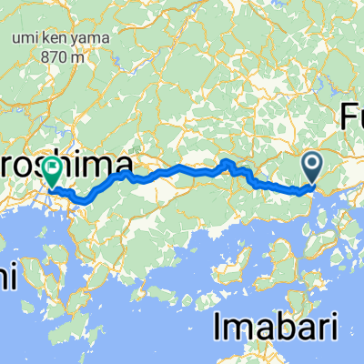 Mihara - Hiroshima
- Distance
- 81.6 km
- Ascent
- 1,786 m
- Descent
- 1,777 m
- Location
- Mihara, Hiroshima, Japan
 廣島1000
- Distance
- 955.6 km
- Ascent
- 2,971 m
- Descent
- 2,980 m
- Location
- Mihara, Hiroshima, Japan
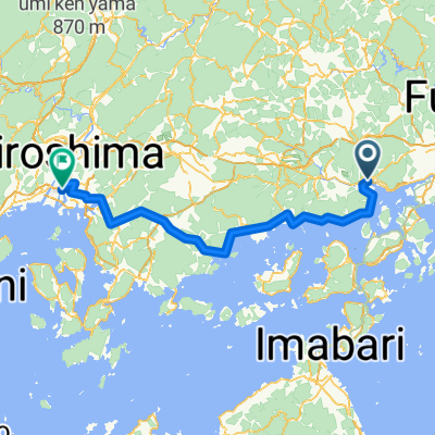 Mihara - Hiroshima
- Distance
- 81.4 km
- Ascent
- 172 m
- Descent
- 148 m
- Location
- Mihara, Hiroshima, Japan
Open it in the app